| DEAL ISLAND WEATHER |
| Web Counters | ||||||
|
|
- Written by Skipjack Heritage -
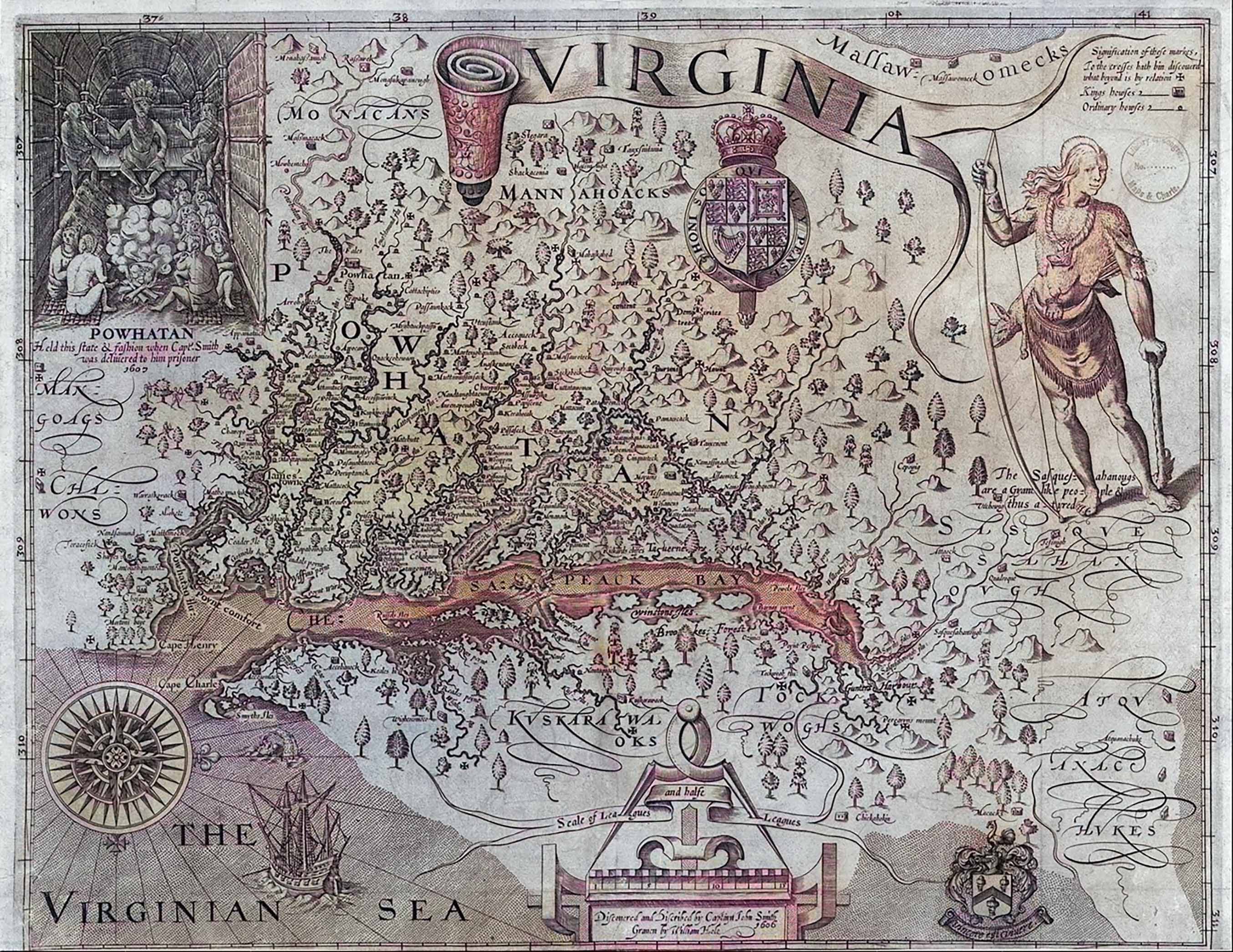
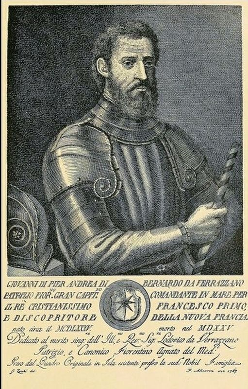
According to author Earl Schenck Miers, geologists are fellows with a sense of humor who, drawing upon facts they alone can observe, delight in astonishing their friends with such intelligence as the revelation that the Chesapeake Bay is actually a “drowned river.” Geologists tell us that the ocean rolled across the peninsula now known as the Eastern Shore four separate times, repeatedly overwhelming the ancient Susquehanna River. Each time the Eastern Shore rose again from the sea, the stubborn old Susquehanna resumed carving its channel southward. Eventually, it traveled approximately 135 miles beyond its present Later and before English settlement, the region was inhabited by Indigenous peoples including groups connected to the Pocomoke and Annemessex areas of the Eastern Shore. Many historians believe that Giovanni da Verrazzano was the first European explorer to enter the Chesapeake Bay and set foot on the Eastern Shore, as early as 1524. Nearly a century before the establishment of the first permanent English settlements along the Chesapeake Bay, European navigators were exploring the Atlantic coastline and encountering the Indigenous peoples who had inhabited the region for countless generations. In 1524, the Italian navigator Giovanni da Verrazzano, sailing under the sponsorship of King Francis I of France aboard the Dauphine, explored portions of the eastern coastline of North America, including areas believed to have been along the Delmarva Peninsula. Historical interpretations suggest that Verrazzano may have reached the vicinity of the Pocomoke River and encountered Native inhabitants of the lower Eastern Shore, although the precise locations of his landings remain uncertain. His surviving account describes several encounters with Indigenous people. During one meeting, a young Native man approached the Europeans with curiosity. When a crew member discharged a firearm, the unfamiliar explosion reportedly frightened the young man so severely that he trembled and fell to his knees. During another excursion, Verrazzano and approximately twenty members of his crew ventured inland through wooded and marshy terrain. There they encountered an elderly Native woman and a younger woman, accompanied by six children. According to Verrazzano's account, other inhabitants had fled into the surrounding forest upon the Europeans' arrival. The encounter took a troubling turn when the explorers forcibly took a young boy from the elderly woman, intending to carry him back to France. They also attempted to seize the younger woman but abandoned that effort when she resisted. These episodes provide some of the earliest surviving European descriptions of encounters with Native peoples along the mid-Atlantic coastline. They also reveal the fear, misunderstanding, and coercion that sometimes accompanied these first contacts. 1602 - In search for the Lost ColonyNearly eighty years later, in July 1603, the English explorer Bartholomew Gilbert sailed into the Chesapeake Bay during an expedition to the North American coast. Gilbert and four members of his party went ashore, probably somewhere along Virginia's Eastern Shore, where they were killed in an encounter with Native inhabitants. The circumstances surrounding the confrontation remain uncertain. Whether it resulted from fear, hostility, territorial defense, or earlier experiences with European visitors cannot be established from the surviving evidence. Nevertheless, Gilbert's ill-fated expedition illustrates the dangers and uncertainties that characterized European exploration of the Chesapeake region at the beginning of the seventeenth century. Only a few years later, the establishment of Jamestown in 1607, followed by Captain John Smith's explorations of the Chesapeake Bay in 1608, would mark the beginning of a more sustained period of English expansion and contact with the region's Indigenous communities. These early encounters preceded the trading activities, colonial land patents, and permanent settlements that would eventually reshape the Manokin River watershed, Smith Island, Deal Island, and the surrounding shores of lower Somerset County. The Italian navigator, sailing in the service of King Francis I of France aboard the Dauphine, reportedly received a friendly greeting from a young Native man. When a sailor fired a gun into the air, the frightened young man fell to his knees as if in prayer. About eight miles up the Pocomoke River, the landing party became mired in the swamps, where they encountered an elderly Native woman and a young girl caring for six children. These early encounters took place before the establishment of the first permanent English settlement at Jamestown, Virginia, in 1607, and the subsequent explorations of the Chesapeake Bay by Captain John Smith in 1608. Together, these voyages marked the opening chapters of European contact with the Indigenous peoples of the region, preceding the expansion of English trade, colonization, and eventual settlement along the waterways of the lower Chesapeake Bay, including the Manokin River, Smith Island, and Deal Island. European colonization dramatically reduced Native populations through disease, land displacement, and conflict during the seventeenth century. Years before the white man came to the Island it was known to be the Indian country of the Manokin Tribe. Their wigwams lined the shore and their canoes skimmed the waters of Tangier Sound. They loved the creeks and the forests, both of Captain John Smith, exploring the Chesapeake Bay in 1608, marveled at the tremendous variety and quantity of fish inhabiting its waters. The abundance was particularly evident in the tidal rivers and shallow estuaries, where immense oyster reefs, migrating fish, and productive marshlands supported a thriving natural environment. Long before the arrival of Europeans, the Indigenous peoples of the Chesapeake region had depended upon these resources for countless generations. Fish, oysters, crabs, and other shellfish provided essential food, while the rivers and tributaries served as natural highways for travel and trade. The importance of the Chesapeake's natural resources became especially apparent during the disastrous winter of 1609–1610, remembered in colonial history as Jamestown's Starving Time. Faced with severe food shortages, disease, drought, and deteriorating relations with neighboring Indigenous communities, the English colonists struggled desperately to survive. Oysters were among the important food resources available to the struggling settlement. Archaeological discoveries at Historic Jamestowne have revealed substantial deposits of oyster shells, providing evidence of their importance during the colony's early years. In May 1610, arriving settlers brought a large quantity of oysters gathered near the mouth of the James River to help feed the survivors of the terrible winter. Archaeologists have identified evidence of this oyster feast within the remains of the early settlement. Although oysters alone did not save Jamestown, they provided an important source of nourishment during a period when food was desperately scarce. The great oyster reefs and fisheries that helped sustain the earliest inhabitants and colonists would, over the following centuries, become the foundation of one of America's most significant maritime industries. From the Indigenous fishing communities of the lower Chesapeake to the oyster dredging fleets of Tangier Sound, the region's extraordinary natural abundance shaped the livelihoods, settlements, and traditions of generations. It was this remarkable wealth of the Chesapeake Bay that would eventually support the watermen, oyster houses, fishing fleets, and sailing skipjacks that became so closely associated with Deal Island, Smith Island, and the maritime heritage of lower Somerset County. Records show that Virginian “John Westlock” was the first white man to trade with the Indians around 1620. He made frequent trips to the Island bringing cloth, looking glasses, kettles, tobacco and blankets giving them to the Indians in exchange for their rich furs and pottery. The Indians did not keep the Island long as their own. The white men knew of it and soon began to settle there. As more families came the Indians became restless and in a short time left the [Deal] Island to go north into Delaware where they joined the Algonquin tribe. In 1666, Westlock received a land patent from the Calvert family known as “Brownstone,” located on the north side of the Manokin River near Trading Branch Fork. Among the earliest settlers were Stephen Horsey, Ambrose Dixon, Randall Revell, and eventually many others, including John Evans at Smith Island, which was named after Henry Smith. Smith patented the 1,000-acre plantation known as “Pitchcroft” on June 3, 1679. The first recorded land grant in the area that later became Deal Island was issued to John Laws in 1676. In keeping with English tradition, these early communities were officially organized into districts known as “hundreds.” Historical significance
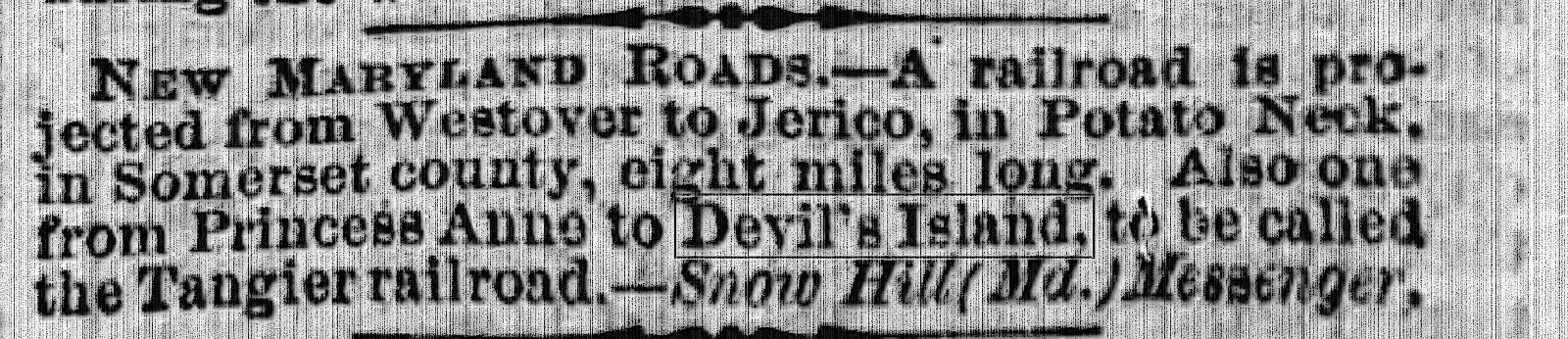
Long before European settlers established permanent communities along the shores of the lower Chesapeake Bay, the waterways, forests, marshlands, and islands of what would become Somerset County, Maryland, were home to Indigenous peoples whose lives were closely connected to the land and water. Among these early inhabitants were the Manokin (Manonoakin) and Annemessex peoples, associated with the larger Pocomoke Native community. Their settlements, fishing grounds, hunting territories, and trading places extended throughout portions of the lower Eastern Shore. The Manokin River was particularly important, serving not only as a source of food and transportation but also as a meeting place where Native inhabitants exchanged goods with neighboring communities and, eventually, European traders. The Manokin Indians were a sub-tribe or band of the Pocomoke Paramountcy and were located in a Neck known as Arrococo by the native people and later called Revel’s Neck (see Randall Revell, 1613-1686/7). This area is best described as the lands on the south side of the Manokin River and the Additionally, long before these colonial land grants were recorded, Indigenous peoples had traveled through and occupied the island landscapes surrounding Tangier Sound. Over the years, residents have reported discovering numerous artifacts along the beaches, fields, and shorelines of Deal Island. Among the objects described in local historical accounts are stone arrowheads, hatchet or axe heads, fragments of pottery, and ornaments fashioned from shells. These discoveries offer tangible reminders of the people who lived, worked, hunted, fished, and traveled through the region centuries before the arrival of European settlers. Local accounts also describe traces of a Native American village on land later owned by William White, although further archaeological documentation would be needed to establish its precise location and history. Such accounts remain an important part of the island's remembered past and may provide valuable clues for future historical and archaeological research. One particularly interesting tradition concerns the winding roadway connecting Wenona and Deal Island village. According to longstanding local accounts, portions of this route followed an earlier Native American footpath as noted prior and not to be redundant................, remembered by residents as the old Indian trail. The road's many curves were traditionally explained as following the higher and firmer ground through an otherwise low-lying landscape of marshes, tidal creeks, and wetlands. For travelers on foot, these natural ridges would have offered more practical routes across the island than the surrounding marshland. Although the precise relationship between today's roadway and any earlier Indigenous trail has not been conclusively established, the tradition reflects the importance of local geography in shaping the movement of people through the island over many generations. Even today, the winding road between Wenona and Deal Island serves as a reminder of how the natural landscape influenced settlement, transportation, and daily life. The Nanticoke Indians were also a local relavent Native American tribe. It appears that English settlers from the Colony of Virginia Colony were visiting this region long before Somerset County was officially formed or the Province of Maryland was settled. Strong evidence of this early presence is preserved within the judicial records of Somerset County. Following 1660, many settlers migrated from Virginia’s Eastern Shore into this area. Two principal reasons encouraged this movement: first, much of the desirable land in Virginia had already been claimed, while fertile and available land remained plentiful in Somerset; second, Virginia’s government maintained limited tolerance for religious groups outside the established Church of England. Depositions preserved in the early Somerset County court records provide remarkable glimpses into trade and daily life along the Manokin River watershed during the seventeenth century. One particularly significant account concerns John Westlock, an early English trader who testified in 1670 that he had been conducting business with Native inhabitants at a place known as Trading Branch approximately fifty years earlier. If Westlock's recollection was accurate, his activities would date to approximately 1620, decades before the establishment of Somerset County in 1666. Trading Branch was located near the Manokin River in the vicinity of what later became known as King's Creek, near present-day Princess Anne. The surrounding area, known to Native inhabitants as Arrococo, included land later called Revell's Neck. Additional seventeenth-century depositions describe English traders arriving by small sailing vessels from Virginia, sometimes accompanied by interpreters who helped establish communication and obtain permission to visit Native settlements. These early accounts describe established Indian towns, trading places, and waterways that were already familiar to Indigenous inhabitants long before European colonization. In 1666, John Westlock received a land patent from the Calvert proprietors for a tract known as Brownstone, situated on the north side of the Manokin River near the Trading Branch area. Westlock's testimony and the surviving accounts of other early travelers provide important evidence of commercial and cultural encounters between Native peoples and Europeans during the earliest documented period of English activity in the region. Numerous relics discovered along the beaches and within cultivated fields continue to reveal the story of Native life in the region. Arrowheads, stone hatchets, shell necklaces and bracelets, and fragments of pottery all stand as evidence of Indigenous habitation on the island. Additional traces of an Indian village once existed on land later owned by William White. The winding road stretching from Wenona to Deal Island village follows what was long known as the old Indian trail. Its many curves reflect the paths chosen on foot by Native travelers seeking the highest ground across the marshlands. 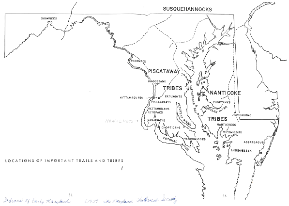 As early as 1607, in the history of Captain John Smith’s first voyage of exploration of the Chesapeake Bay he states there is but one entrance by sea into this Country and it is at the mouth of a very goodly Bay, 18 to 20 myles broad........ He crossed from the new settlement of Jamestown to the Eastern Shore (Somerset County) and after several adventures discovered what was called at the time "Russell Isles (Tangier, Smith, Hollands, South Marsh, Bloodsworth, etc.) and named after the doctor (Dr. Walter Russell) that accompanied Captain John Smith on his voyage, where they saw many creeks, rivers and islands. The early settlers found the Indians raking oysters from the bottom wherethis tradion still continues today. Many islands were noted where among the largest were Tangier Island, Smith, Deal and Holland Islands. Captain Smith mentions in his writings that [Deal] the Island was one of his prominent landmarks as he sailed around the Bay (and would later search for any living from the Roanoke Colony). Several years passed before three ships were finally outfitted to venture across the Atlantic Ocean. The voyage progressed successfully until the vessels entered the waters of the Chesapeake Bay and encountered a violent hurricane. Two of the ships managed to reach Accomack County, but the third was driven far off course into Tangier Sound. Its sails were torn away, the mast shattered, and much of the crew perished in the storm. The few survivors were left helpless against the wind and sea. During the darkness of the night, the crippled vessel was blown ashore and wrecked. “According to a long standing Deal Island legend…” rather than documented history the shipwreck, the great storm, we find the legend of Devil's Island When morning finally broke and the violent storm had subsided, the weary and exhausted survivors gazed back across the turbulent waters of Tangier Sound. Turning toward the unfamiliar shoreline, they found themselves surrounded by seemingly endless stretches of desolate marshland, tidal creeks, and wilderness. Overwhelmed by their ordeal and the isolation of their surroundings, the shipwrecked men reportedly exclaimed in despair, “This is Purgatory—the land of the Devil!” According to longstanding local tradition, this dramatic encounter gave rise to the name Devil's Island, one of the names associated in folklore with what would eventually become known as Deal Island. The same storm was also said to have dramatically altered the island's geography. Local accounts describe powerful winds and surging tides cutting a broad channel through the surrounding marshlands, separating approximately thirty acres from the southern end of the main island. This isolated tract later became known as Little Deal's Island. As the stranded sailors made their way across the unfamiliar marshes, they encountered Indigenous inhabitants who, according to the legend, had witnessed the vessel's destruction from a distance. The Native people initially regarded the strangers with caution and suspicion, reportedly fearing that they might be pirates seeking shelter along the remote shores of Tangier Sound. Such concerns reflected the dangers associated with unfamiliar vessels and travelers in Chesapeake waters during the colonial period. Through gestures and attempts at communication, the shipwrecked men eventually convinced the inhabitants that they posed no threat and sought only shelter and peaceful relations. According to the traditional account, the survivors were then welcomed into the nearby Native village, where they found refuge after their harrowing experience at sea. Whether preserved as historical fact or embellished through generations of storytelling, the legend of the shipwreck, the great storm, and the naming of Devil's Island remains a fascinating part of Deal Island's early folklore and maritime heritage. For generations, local tradition held that Deal Island was once known as Devil’s Island and that pirates later used the isolated marshes and waterways as a convenient hiding place. The precise date of the shipwreck, along with the identities of the survivors, has long since been lost to time. Yet supporters of the story point to one surviving piece of evidence suggesting the tale was rooted in history rather than legend — the recorded deed for a tract of land named “Purgatory,” preserved in the county clerk’s office. Although no exact date for the first permanent settlement of the region has been firmly established, historical records indicate that English-descended families were establishing communities throughout the lower peninsula by the mid-to-late seventeenth century, with some ancestry tracing back to the earliest colonial settlements of the early 1600s. One local tradition further suggests that the first settlement in the immediate area may have been a place known as “Pidgeon House” around 1632.
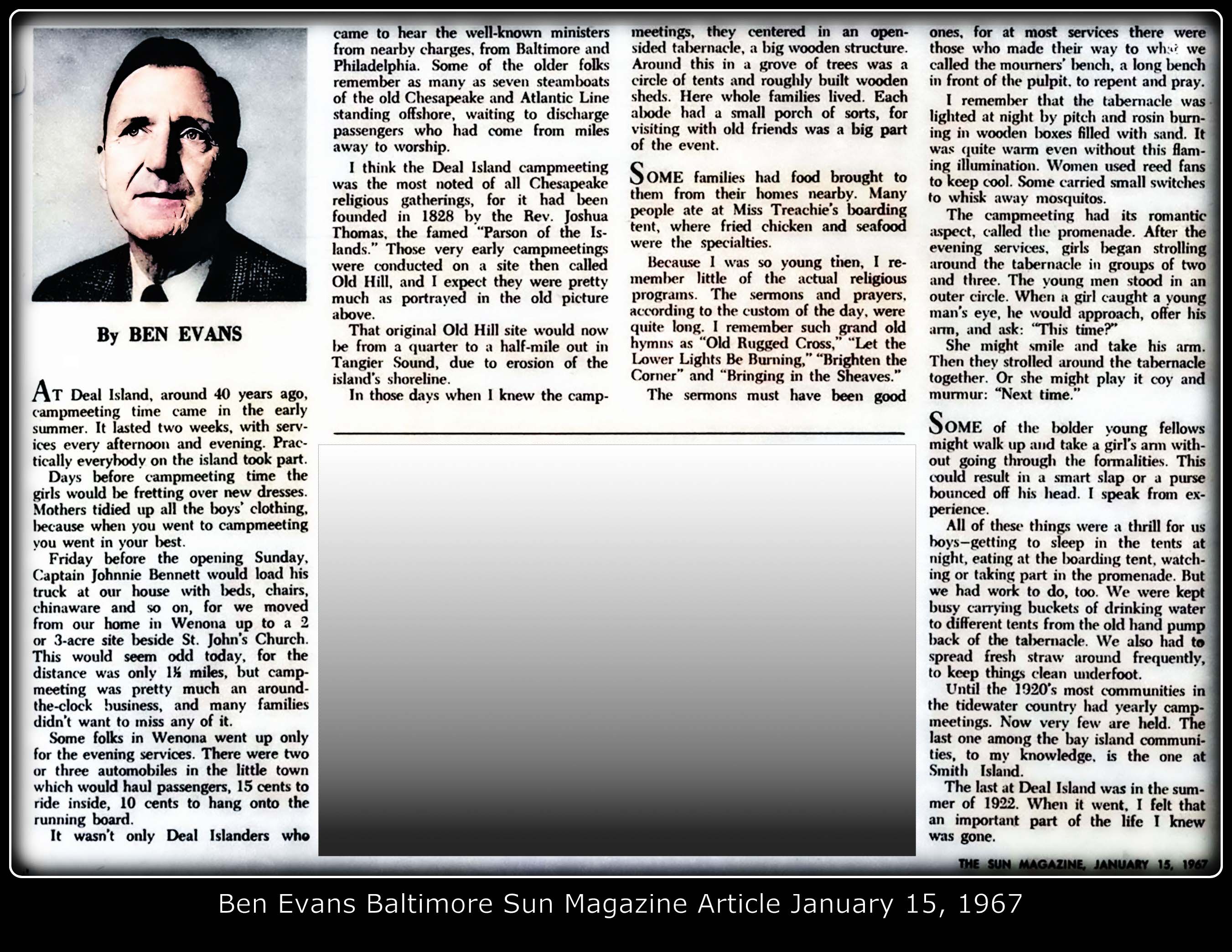
Deal Island has been known through the centuries by several variations of its name, including “Devil’s Island,” “Deils Island,” “Deals Island,” and eventually the modern spelling of Deal Island used today — a standardization largely attributed to government recordkeeping and postal usage over time. Among the earliest recorded land patents on Deal Island in Somerset County were tracts known as “Christopher Oldsfield,” “Lloyds Grove,” and “Cowley.” Additional patents issued to Thomas Roe included “North Foreland” in 1676, as recorded in the colonial rent rolls. William Bradshaw later purchased portions of “Lloyds Cove” and “Cowley” in 1665. Land patents granted to Robert King on the lower end of the island, in the area now known as Wenona, included “Self Preservation” in 1745, “Support” in 1744, and “Barbodeas” in 1725. These colorful tract names reflected the hardships, isolation, and determination associated with life on the lower Eastern Shore during the colonial era. John Lawes is recognized as the first white man to receive a land grant on Deal Island in 1676, marking one of the earliest officially documented English claims in the region. . Within a short time, small boats from Deal Island were transporting oysters to nearby towns and villages. Larger sailing workboats soon followed, carrying oysters, crabs, and other seafood products to the growing markets of Baltimore. These early ventures marked the beginning of the Island’s seafood industry, through which Deal Island, Crisfield, Smith Island, and neighboring communities became major exporters of Chesapeake seafood to Baltimore and beyond. The channel separating the island from the mainland became known as “Lawes Thoroughfare,” named in honor of John Lawes. Robert King owned approximately 300 acres of tillable land along with 200 acres of marsh and sandy ground on the lower end of what was then called Devil’s Island, although no surviving record confirms that he ever resided there personally. His land patents were eventually deeded to Robert J. H. King and Nehemiah King. Deal Island and surrounding communties have a heritage that predates the skipjack by hundreds of years, if not more. The maritime history of Deal Island, Smith Island, and lower Somerset County did not begin with the arrival of the oyster dredging fleets or the development of the Chesapeake Bay skipjack. Its roots reach much farther into the past—to the Indigenous communities as already decribed who navigated these waterways, the early trading vessels that entered the Manokin River, and the families who established settlements along the shores of Tangier Sound. The Manokin River, Trading Branch, Lawes Thoroughfare, and the old pathways of Deal Island preserve connections to these earlier chapters of local history. Together, the surviving colonial records, archaeological discoveries, family histories, and local traditions help tell the story of a region shaped by its people and their enduring relationship with the Chesapeake Bay. On October 24, 1795, David Wallace purchased from Nehemiah King seventy acres known as “Support” for 116 pounds, 16 shillings, and 3 pence. Several years later, Wallace also acquired the patent called “Barbadoes.” Wallace became the first local preacher on the island and was later ordained as an Elder. Many of the island’s early marriages were solemnized within his own home, which served as the first known place of organized religious worship on Deal Island. Although the original house was eventually destroyed by fire, the property was later purchased by William Price, who constructed another residence there that later became the home of Mr. and Mrs. Eddie Shores. During the colonial era, tobacco served as the principal export from the region. Later, wheat and other grains were shipped to England and the West Indies, while returning vessels carried household goods and supplies back to the Eastern Shore settlements. Although many northern colonies strongly supported independence from the British Crown, enthusiasm for revolution never became widespread in Somerset County, particularly in the lower Somerset communities surrounding Deal Island and Smith Island. Loyalist privateers and so-called Tory pirates — including Marmaduke Mister, Stephen Mister, John Evans, and Joseph Wheland — terrorized the lower Chesapeake region during the late 1770s. Their raids and activities contributed to continuing unrest that culminated in the 1782 Battle of the Barges at Kedges Straits in lower Somerset County, considered one of the last naval engagements of the American Revolutionary War. Among the names prominent in island history before the Revolution were William Bradshaw, Thomas Roe, Robert Rowe, and John Lawes. Families arriving during the Revolutionary era included the Tyler, Evans, Crockett, Parks, Mister, and Thomas families. Many were of Anglo-Saxon and Welsh descent, developing a largely self-sufficient way of life shaped by the isolation, waterways, and traditions of the Chesapeake Bay region. On The most prominent arrival in the first half of the 19th century to the Island came from Tangier Island. He was the preacher Joshua Thomas, the Parson of the Islands born 1776 in Potato Neck [married to Rachael Evans from Smith Island and after she died in 1797 he married Charlotte Bradshaw]...........(Baltimore Sun 1955 newspaper article) who had warned the British army who occupied a base at Tangier Island they would be defeated at Baltimore where the British General Ross gave him his title of "Parson of the Islands." Joshua Thomas standing before 12,000 British troops tried unsuccessfully not only ministering to them, warning them and taking care of his own congregation, local residents. With his brother in law Aaron Bradshaw, he purchased Little Deals Island and named it “Little Eden.” After the death of Aaron Bradshaw, Solomon Evans a wealthy planter from Smith Island bought his home and lived there for many years. Joshua Thomas apprenticed with fisherman David Tyler of Smith Island where he honed his boating skills and learned about Methodism. Joshua Thomas, widely known throughout the Chesapeake region as “Brother Thomas,” became one of the most influential religious leaders in the history of Deal Island and the surrounding islands. Following the death of David Wallace, Thomas succeeded him as the island’s local Methodist preacher and was later ordained as a deacon of the church. Through his tireless ministry and travels among the isolated fishing communities of the lower Chesapeake, he almost single-handedly advanced the spread of Methodist Episcopal Church throughout the area. Thomas and his family relocated to Deal Island from Tangier Island around 1825. His ministry quickly became deeply rooted among the watermen and island families of the region. In 1828, he established an annual Methodist camp meeting at a location known as Old Hill on Deal Island. These gatherings became major religious and social events, drawing people from communities across the lower Eastern Shore and Chesapeake Bay islands. In appreciation for his service, the people of the island presented Brother Thomas with a large dugout canoe which he named “Methodist.” The canoe was carved from a single massive log, measured more than twenty feet in length, and had a beam of approximately five feet — evidence of the enormous tree from which it was fashioned and carried 2 masts. The log canoe was a forerunner of the Chesapeake Bay Bugeye. Using this remarkable vessel, Thomas traveled the Chesapeake waterways preaching, visiting isolated families, and organizing Methodist societies throughout the bay region.
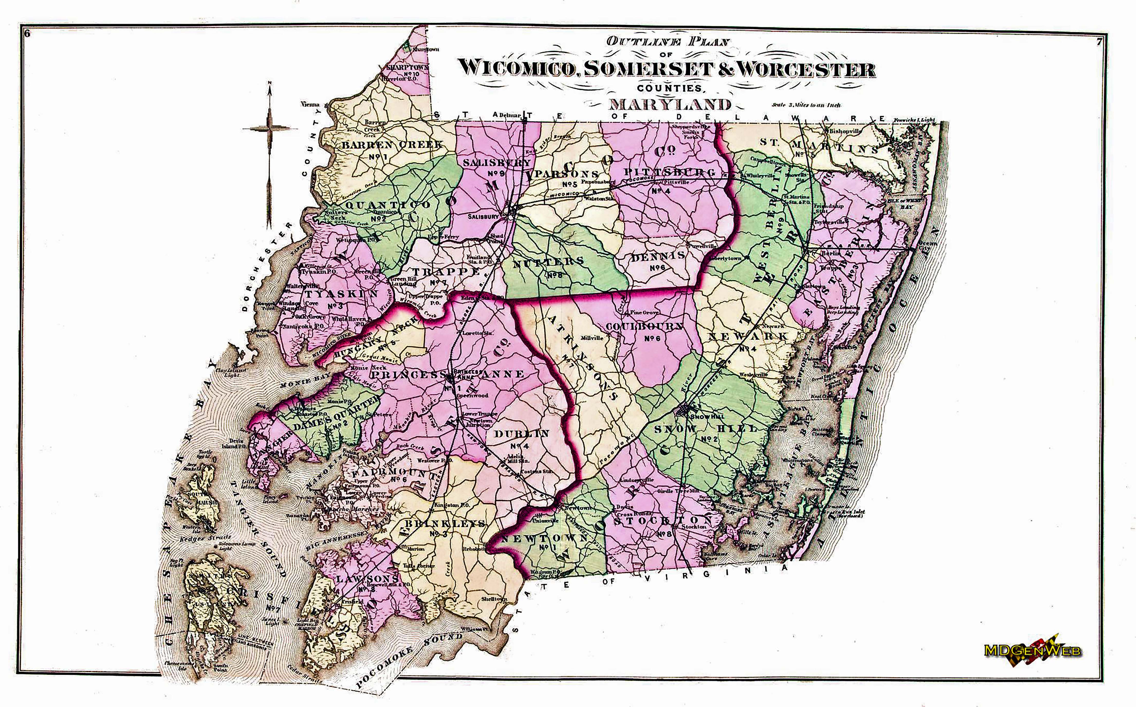
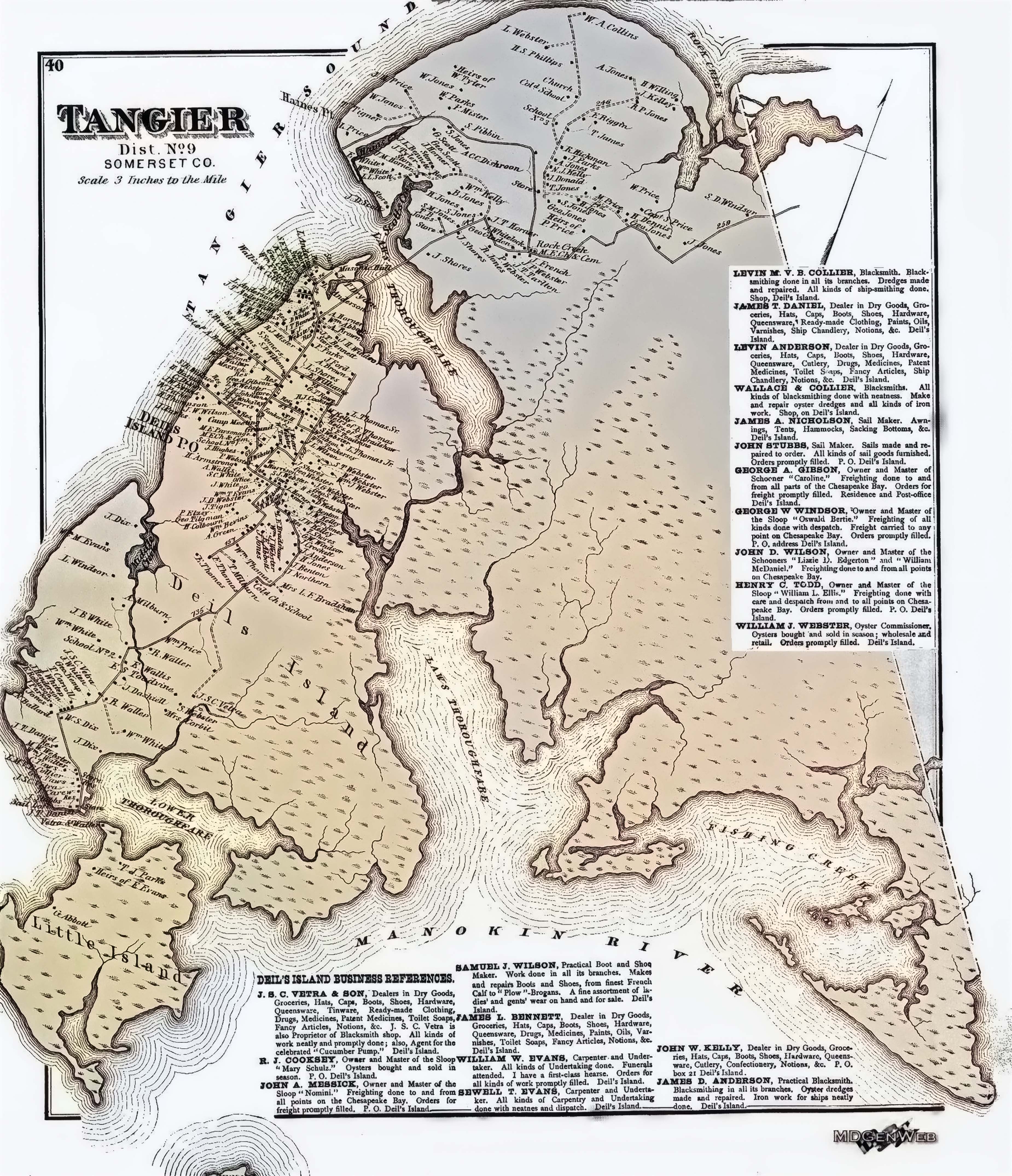
According to local tradition, it was during a prayer meeting held at the home of John Parks that one of the visiting Methodist ministers proposed changing the island’s name from “Devil’s Island” to “Deil’s Island.” The minister reportedly explained that “Deil” was a Greek term associated with the word “devil,” and that the altered spelling might soften the harsh reputation long attached to the community while still preserving its historic identity. By the late nineteenth century, the revised form had gained acceptance in official usage. Maps issued around 1870 identified the community as “Deil’s Island” rather than “Devil’s Island,” reflecting the gradual transition in spelling that would eventually evolve into the modern name of Deal Island. The changing forms of the island’s name — Devil’s Island, Deil’s Island, Deal’s Island, and finally Deal Island — illustrate how local tradition, religion, government records, and common usage collectively shaped the identity of the Chesapeake community over time.
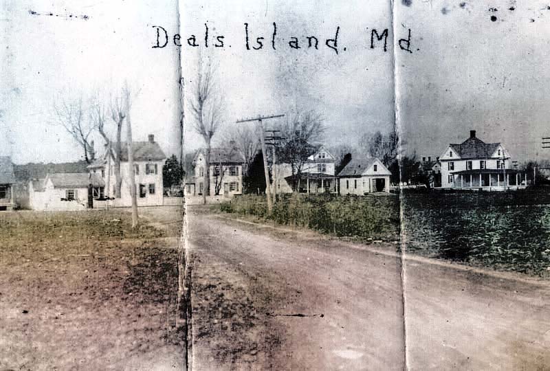
In the mid-19th century, life on Deal Island was shaped as much by isolation and environment as by tradition. Formal medical care was limited, so folk medicine and home remedies passed down through generations served as the primary form of healthcare. The community was tightly knit, and neighbors and extended families routinely cared for the sick together, sharing knowledge, labor, and resources when illness struck. Historical accounts suggest that over time islanders may have developed a degree of natural resistance to certain local illnesses through repeated exposure. The most common diseases of the period reflected broader 19th-century conditions across rural America, including malaria, smallpox, typhoid fever, measles, and diphtheria. The surrounding marshlands contributed significantly to health challenges, as mosquito-borne illness was widespread, and contaminated or poorly filtered water sources often led to outbreaks of waterborne disease. Childbirth, too, remained hazardous due to limited medical knowledge and the absence of trained physicians nearby. By 1850, the population of Deal Island had grown to roughly 500 residents, reflecting steady settlement growth since the colonial era. Families took pride in improving the island’s infrastructure and way of life. Roads were gradually constructed and maintained using compacted oyster shells, a practical material abundant in the Chesapeake Bay region. As transportation evolved, horse-drawn carriages increasingly replaced horseback travel for longer distances, and small but permanent homes began to appear along the developing roadways. Despite its isolation, the island community continued to strengthen its internal economy, traditions, and mutual support systems, forming a resilient society shaped by the unique conditions of life on the Chesapeake. 1877 Atlas Map of Somerset County Until about 1878, when steamboat service began improving access along the Chesapeake, nearly all transportation to and from Deal Island was by water. Travel by land was possible, but slow and difficult. A rough, winding road connected the island to Princess Anne, the county seat of Somerset County. That overland route followed a circuitous path through small rural communities, including Chance, then southward through Oriole, Dames Quarter, St. Stephens, and portions of Venton. A journey by horse and wagon could take an entire day under good conditions—and far longer when weather turned poor. Rain and winter snow made the roads nearly impassable at times, while summer heat and mosquitoes from surrounding marshlands added another layer of hardship. For much of the island’s early history, access was primarily by ferry across the surrounding waterways. This dependence on water transportation shaped daily life, commerce, and even social interaction. By the 19th century, infrastructure slowly began to improve. A bridge was eventually constructed across the local thoroughfare, and in the early 20th century a more substantial and durable bridge replaced earlier structures, providing more reliable access between the island and mainland. These gradual transportation changes marked an important shift for Deal Island, connecting what had long been an isolated maritime community more closely to the broader region while still preserving its strong ties to the Chesapeake Bay.
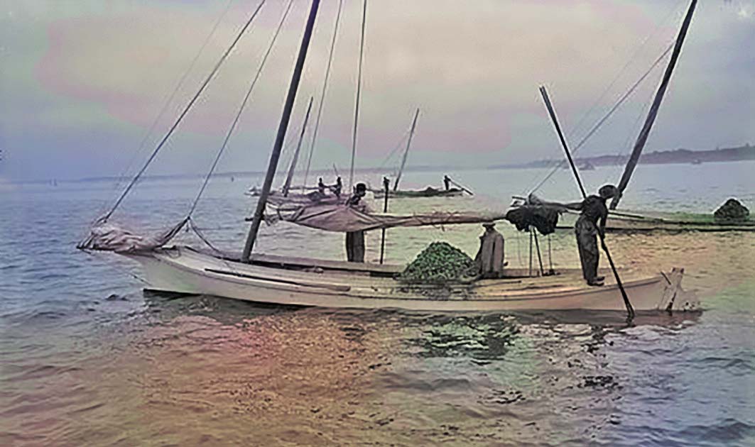
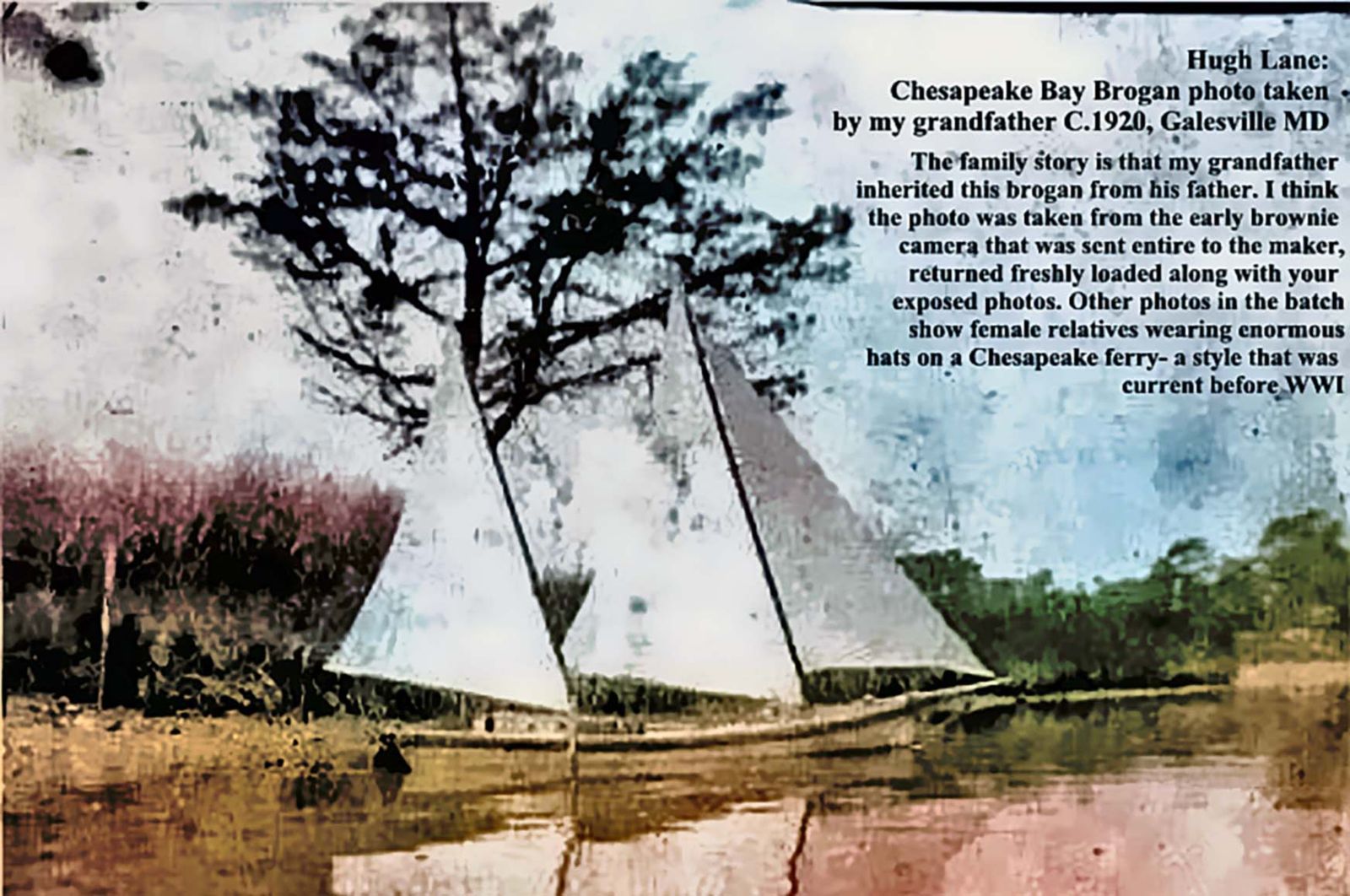
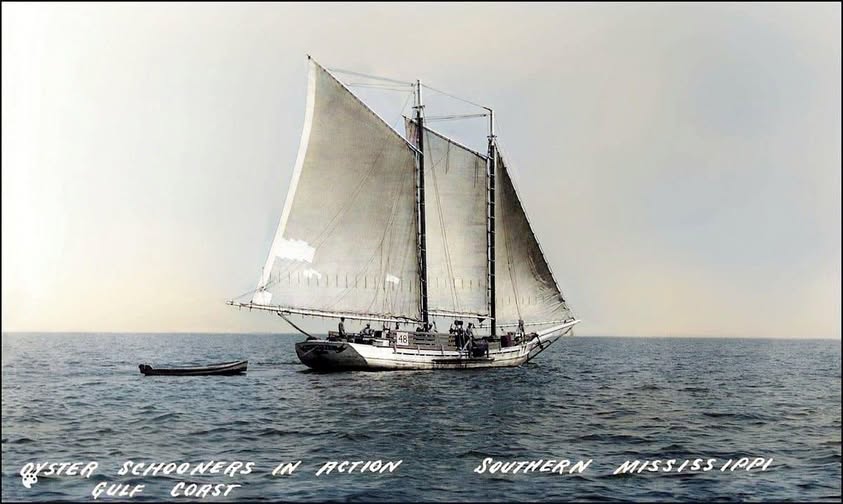
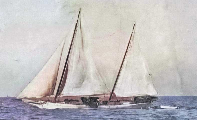
There were, of course, variations within each type of Chesapeake working vessel, shaped by local craftsmanship, available materials, and the needs of individual watermen. On Deal Island, several small but active boatyards contributed to this tradition—one located on the northern end of the island and another on the lower eastern side in the area known locally as “the Creek.” These yards played an important role in building and repairing the sailing craft that supported the island’s seafood economy. The Skipjack, which emerged in the 1880s, became one of the most important vessels in the Chesapeake Bay oyster industry. Designed specifically for shallow waters and efficient dredging, the skipjack represented the peak of working sailboat development in the region. Deal Island craftsmen contributed to this tradition, constructing skipjacks alongside watermen who relied on them for their livelihood. One of the most notable vessels associated with this heritage was the “Robert L. Webster,” built in 1915 in nearby Oriole. At the time of this account, she was under the command of Captain Eldon Willing Sr., a figure remembered locally within the watermen community for his experience and leadership on the bay. Together, the boatyards, vessel designs, and families who operated them reflect the deep maritime identity of Deal Island—an economy and culture shaped almost entirely by the Chesapeake waters that surrounded it.
By 1878 the days of traveling by sail exclusively came to an end when steamboats
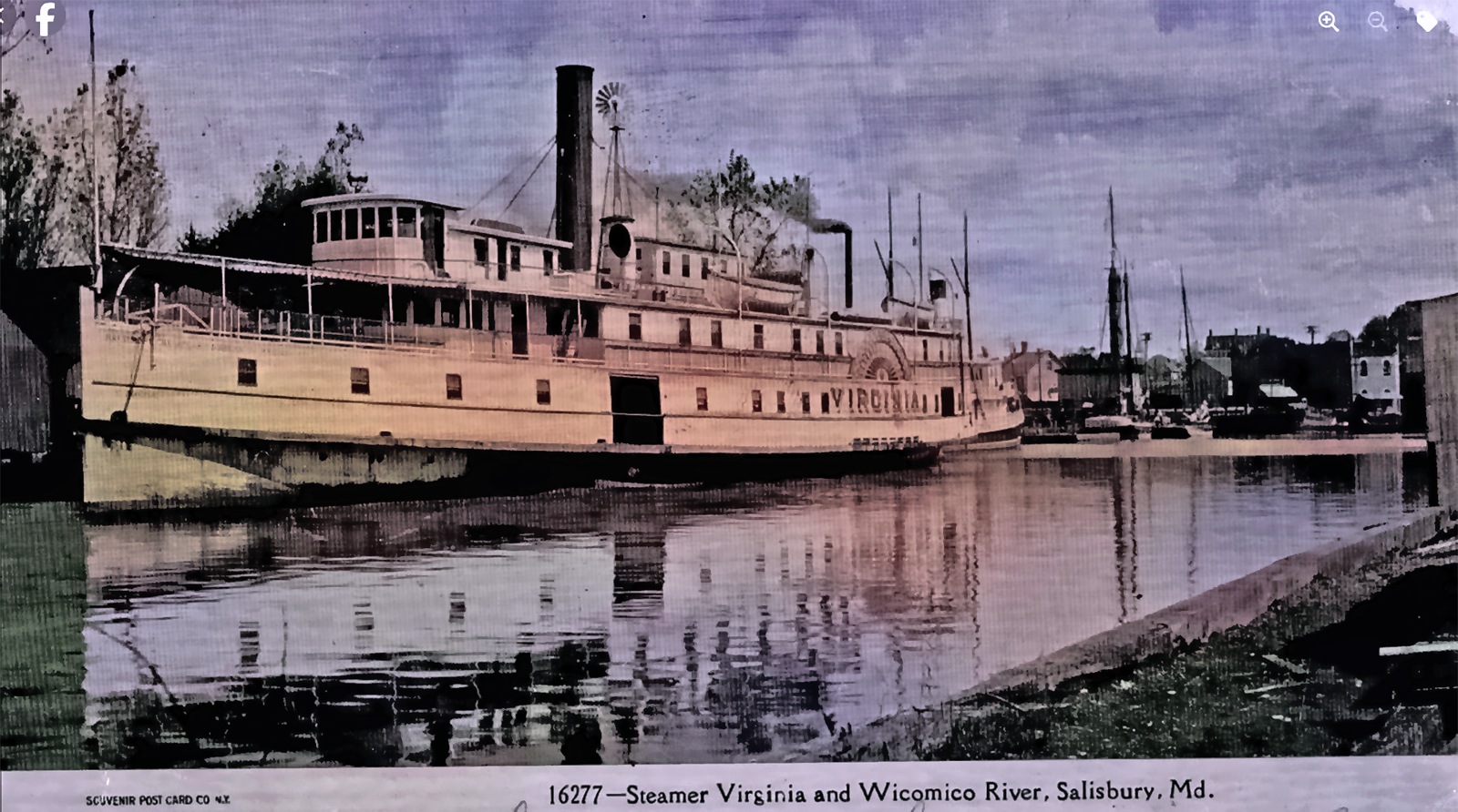
For generations, the people of Deal Island depended almost entirely upon sailing vessels and small boats for transportation, trade, and communication with the outside world. Surrounded by the waters of Tangier Sound and the marshlands of lower Somerset County, the island remained closely tied to the Chesapeake Bay and its traditional maritime way of life. That began to change dramatically in 1878, when regular steamboat service connected Deal Island with Salisbury, Baltimore, and other communities throughout the Chesapeake Bay. The arrival of the steamboats ushered in a period of economic opportunity, improved communication, and greater accessibility for the island's residents, farmers, merchants, and watermen. The steamers Tangier and Virginia began operating scheduled routes between Salisbury and Baltimore in 1878, making regular stops at Deal Island. According to historical accounts, the steamboats arrived at the island's wharf at approximately 6:00 PM daily, except Saturdays. On the return journey from Baltimore, they reached Deal Island during the early morning hours, usually around 3:00 AM. These regular arrivals and departures provided an important transportation link, allowing passengers, agricultural products, seafood, merchandise, and mail to travel between the island and the larger commercial centers of the Chesapeake Bay. Captain Levin A. Anderson, an important figure in the island's early commercial development, provided land to the Baltimore, Chesapeake & Atlantic Steamship Company for the construction of a wharf at the northern end of Deal Island. Because of the shallow waters surrounding the island, the pier extended approximately one-quarter mile into Tangier Sound to reach water deep enough to accommodate the steamboats. The wharf soon became one of the most important centers of activity on Deal Island. Captain Levin A. Anderson served as the first local steamboat agent. He was succeeded by G. C. Vetra and Mr. Dryden, followed by Adolphus Brown. In 1898, Ralph Brown, the son of Adolphus Brown, assumed responsibility for the agency. He continued serving until the 1930s, when regular steamboat service to the island was discontinued. For several decades, these agents played important roles in coordinating passengers, freight, shipping schedules, and commercial transactions. Their work helped connect the island's agricultural and seafood industries with the markets of Baltimore and other Chesapeake ports. The arrival of steamboat service also brought considerable improvements in postal communication. A post office was established directly at the steamboat wharf and became known as the Soundside Post Office. According to historical accounts, Mrs. Ralph Brown served as its postmistress, handling correspondence arriving and departing aboard the steamboats. Local historical tradition holds that the settlement was originally known by the Native American name Wenoah, which was later standardized by government authorities as Wenona. During this period, mail transportation required the coordination of several people and different methods of travel. Captain Bill Harrison was responsible for collecting outgoing mail from the Wenona and Deal Island post offices and delivering it to the steamboat pier, where it would be placed aboard vessels departing for Baltimore. Mail from inland communities, including Princess Anne, was also transported to the island by horse-drawn teams and buggies. These arrangements illustrate how maritime transportation and traditional overland travel worked together to serve the residents of lower Somerset County before the development of modern highways and motorized mail delivery. The wharf became the center of island life and by the turn of the twentieth century, the steamboat wharf had become much more than a place for vessels to dock. It was a center of commercial, social, and economic activity. Near the wharf stood the Anderson ship chandlery and shipyard, where maritime supplies and services supported the island's working vessels. Nearby was the Anderson Hotel, one of the area's best-known accommodations. The hotel consisted of a main building and two smaller structures, with a reported capacity of approximately 85 guests. Commercial travelers, visitors, hunters, and fishermen arriving by steamboat found lodging there, contributing to the island's expanding commercial life. The wharf became a gathering place where residents exchanged news, welcomed visitors, conducted business, and watched the arrival and departure of vessels. A growing market for oysters, seafood, and farm products. Regular steamboat transportation opened new opportunities for Deal Island farmers and watermen by providing more dependable access to Baltimore's commercial markets. By the early 1900s, island farmers were shipping substantial quantities of strawberries, beans, potatoes, and tomatoes, both fresh and canned. Poultry and livestock were also transported aboard the steamboats. One remarkable recollection comes from Albert Anderson, whose father established the Anderson Hotel. Anderson remembered seeing approximately 500 crates of strawberries from the Bradshaw farm loaded onto a steamboat in a single day, in addition to shipments from other local farmers. The crates reportedly held between 32 and 60 quarts each, illustrating the considerable volume of agricultural produce moving through the island's wharf. The seafood industry also benefited from improved shipping connections. Oysters, fish, crabs, and other Chesapeake Bay products could be transported to distant markets, strengthening the commercial activities of watermen, seafood dealers, and local merchants. Eventually it became the end of an era. The steamboats continued serving Deal Island into the twentieth century, remaining an important connection to the outside world until service ended during the 1930s. By then, improved roads, automobiles, trucks, and changing transportation systems were gradually replacing many of the functions once performed by the steamship companies. Nevertheless, the steamboat era left an enduring mark on Deal Island. The wharf, the Soundside Post Office, the Anderson Hotel, and the surrounding commercial establishments represented a period when the island became increasingly connected to the economic and social life of the Chesapeake Bay. For the families who lived through those years, the sound of an approaching steamboat was more than the arrival of another vessel. It brought passengers, correspondence, merchandise, opportunities, and news from beyond the island. The steamboat era remains an important chapter in the history of Deal Island and the generations of watermen, merchants, farmers, and families who helped shape its maritime heritage.
At the turn of the 20th century, stepping off the pier revealed a well-defined shoreline community shaped by maritime commerce. Continuing the Story of Deal Island’s Maritime and Agricultural Heritage the availability of steamship service to metropolitan markets brought many acres of the Islands soil into production. The growth of the seafood industry became the defining economic force for Deal Island and the surrounding Chesapeake communities. As transportation improved and markets expanded, the harvesting and shipping of seafood shifted from a local trade into a large-scale commercial operation tied to regional and national distribution networks. A major turning point came with the introduction of the internal combustion engine. Small workboats equipped with engines could travel faster, carry larger loads, and work longer hours, dramatically increasing the volume of crabs and other seafood harvested from the waters of the Chesapeake Bay. This technological change helped modernize the watermen’s industry and boosted overall production. Across the island, oyster and crab packing houses were established to handle the growing output. These facilities developed specialized methods for preparing seafood for shipment. Soft-shell crabs were packed in large boxes lined with seaweed to preserve freshness, while hard-shell crabs were shipped in barrels. Oysters in the shell were transported in baskets, and shucked oysters were packed in small kegs for distribution. Near Old Hill, a fishery plant operated that processed herring and other fish, canning some products while also shipping salted fish in barrels. These operations extended well beyond local markets. While Baltimore remained a primary hub, shipments were also sent along the East Coast and into the Midwestern United States, reflecting the expanding reach of Chesapeake seafood. This period marked the transformation of Deal Island’s economy from a largely local maritime subsistence system into a significant contributor to a broader national seafood supply chain, while still maintaining its deep-rooted identity as a watermen’s community. With a large production of tomatoes 2 canning plants were built: one owned by Noah Webster between the Old Hill and Hunts Creek. The other was at Wenoma where Harry Wilson’s oyster house was located, also owned by Thomson Wallace. The arrival of the first automobiles on Deal Island marked another striking step in the island’s gradual modernization. One of the earliest motorcars was owned by Henry Brown, the well-known sailmaker whose family business had long served Chesapeake watermen. His vehicle reflected the earliest era of automobile design, featuring a chain drive system and a simple rod-based steering mechanism—far removed from modern standards, but revolutionary for its time. Around the same period, Noah Webster, who had relocated primarily to Baltimore but maintained a secondary residence on the island, also owned an automobile. These early vehicles symbolized the growing connection between Deal Island and the rapidly modernizing world beyond the Chesapeake. After roughly twenty-five years of steamboat service, island residents began to recognize the dramatic improvement in their economic and social conditions. What had once been a remote maritime community was increasingly integrated into regional commerce, and optimism about the island’s future grew noticeably. This sentiment was captured in a letter published in the Princess Anne newspaper in 1895, which stated:
In the same year, there was also a proposal to construct a railroad line connecting the island region to Princess Anne. The steamboat company even contributed $1,000 toward the effort. However, despite early enthusiasm, the project ultimately failed to gain sufficient financial backing from other investors and was never completed. Together, these developments illustrate a turning point in the island’s history—when tradition, maritime industry, and emerging technology briefly converged to reshape expectations for the future of Deal Island. The first bank on the Island was in the store of William Seymore Thomas, grandson of the Reverend Joshua Thomas. The arrival of steamboat service brought noticeable changes not only to commerce on Deal Island but also to everyday family life and social customs. As regular connections to larger towns such as Salisbury and Baltimore became routine, island residents—especially women—began traveling more frequently for shopping and supplies. This broader access introduced new goods and styles into island homes, transforming domestic life in visible ways. Households of watermen increasingly reflected these wider influences. Items such as victrolas, fine linens, imported china, and more elaborate furniture began appearing in homes that had once been furnished in a more purely utilitarian manner. During this period, many well-built residences were constructed, reflecting the growing prosperity tied to the seafood and transportation economy. Family excursions to Baltimore became more common as well, with steamboat travel offering relatively comfortable passage, meals, and overnight accommodations for longer visits. Transportation at the wharf was an important part of this evolving lifestyle. Johnie Bennett played a key role in meeting incoming steamboats, initially with horse-drawn carriages and later with his Dayton automobile. He provided passenger transport and freight delivery services, linking the waterfront directly to homes and businesses across the island. In addition to his transportation work, he also maintained a stable of fine racehorses and participated in local racing events, reflecting the blend of traditional and modern pursuits during this era. Despite these changes, remnants of earlier commercial life remained. General stores from the sailing era continued to operate, but they were now joined by additional service-oriented businesses and small amusement enterprises that reflected a more connected and economically diverse community. One prominent example was the Anderson store located along the wharf road. On the ground floor it supplied groceries and boat provisions essential to watermen, while the upper floor housed Mrs. Anderson’s millinery shop and dry goods store, catering to the growing demand for more varied household and personal goods. Together, these developments illustrate how steamboat-era Deal Island transitioned from a primarily subsistence-based maritime community into a more socially mobile and commercially connected society, while still retaining its strong watermen identity. Preserving this history means remembering not only the boats and watermen who made the lower Chesapeake famous, but also the generations of people who lived along these shores long before the first skipjack ever set sail.
Recreation on Deal Island also expanded significantly during the early 20th century, reflecting the island’s growing population, improved transportation, and increasing social activity tied to steamboat and road access. Commercial life on the island became more diversified during this period. Thompson Wallace operated a two-story department store where residents could purchase nearly everything needed for daily life, and the building also served as a residence for Melvin White. Along the main highway near the ice plant stood another large general store operated by Fred Webster and his father, continuing the strong tradition of family-run commerce. Smaller shops were scattered throughout the island, selling groceries, candy, and ice cream, including early “ice cream parlor” establishments that became popular gathering places. Theresa Thomas—affectionately known as “Aunt Teas”—owned and operated a drugstore that also served as an ice cream parlor, where homemade ice cream could be purchased for a nickel. Nearby, Mr. Charles Ringgold ran a full haberdashery store, serving the clothing and personal goods needs of residents, including those living around the Shores household. Communication and transportation improvements further connected the island to the region. In 1914, the Diamond State Telephone Company established an office on the island, with Mrs. Eva Shores serving as the telephone exchange operator from her home, linking local families to the wider world. In 1928, Mr. Thomas Price launched a bus service running from Wenona across the marsh roads to Princess Anne and onward to Salisbury. One early bus was a converted Model T Ford capable of carrying up to twenty passengers, marking another step in modernization. Cultural life also flourished. Mrs. Mollie Wallace Lively taught oil painting classes for many years, and her artwork—and that of her students—remained displayed in island homes throughout the 1920s. Recreation took many forms: a skating rink and pool room operated near the home of Mrs. Kate Anderson under the management of W.O. Brown and John Bennett. Wenona featured two movie houses, a skating rink, and a merry-go-round, offering entertainment for families and young people alike. A Red Men’s Hall near the Deal Island School provided a large auditorium for community gatherings, while amateur theatrical productions were staged in the Wenona sail loft during the early 1900s. By the early 1930s, recreational opportunities had expanded further with the introduction of an arena used for community events and sporting activities, reflecting the continued evolution of island life from a primarily maritime economy into a more socially diverse and connected community.There were boxing In 1916, the future of the high school on Deal Island came under serious threat when enrollment dropped to only eleven students for the upcoming year. County Superintendent William Dashiell informed the teaching staff that unless at least forty pupils were enrolled, the school would be forced to close. Recognizing what closure would mean for the island’s children and families, Mrs. Elizabeth Bozman (née Anderson) took immediate action. She met with Mr. Dashiell, though initially receiving little encouragement, and then appealed to state educational officials in Baltimore to emphasize the importance of maintaining local secondary education. She also sought assistance from Joshua Miles, a well-connected county leader with strong ties throughout the island community. Together, they worked persistently with local parents, stressing the long-term value of a high school education for island children. Through these coordinated efforts, enrollment steadily increased. By the final week of August, Miss Lizzie—as her students affectionately called her—had successfully enrolled forty-one pupils. As a result, the Deal Island school opened on schedule, preserving educational access for the community and marking an important moment in the island’s commitment to schooling and local development. |

 mouth and found an outlet to the Atlantic Ocean between Capes Charles and Henry. Forty-eight tributaries flow into the olde Chesapeake and the variety of of unchangeable waters, salty, fresh, and brackish all make up the charm of of Chesapeake.
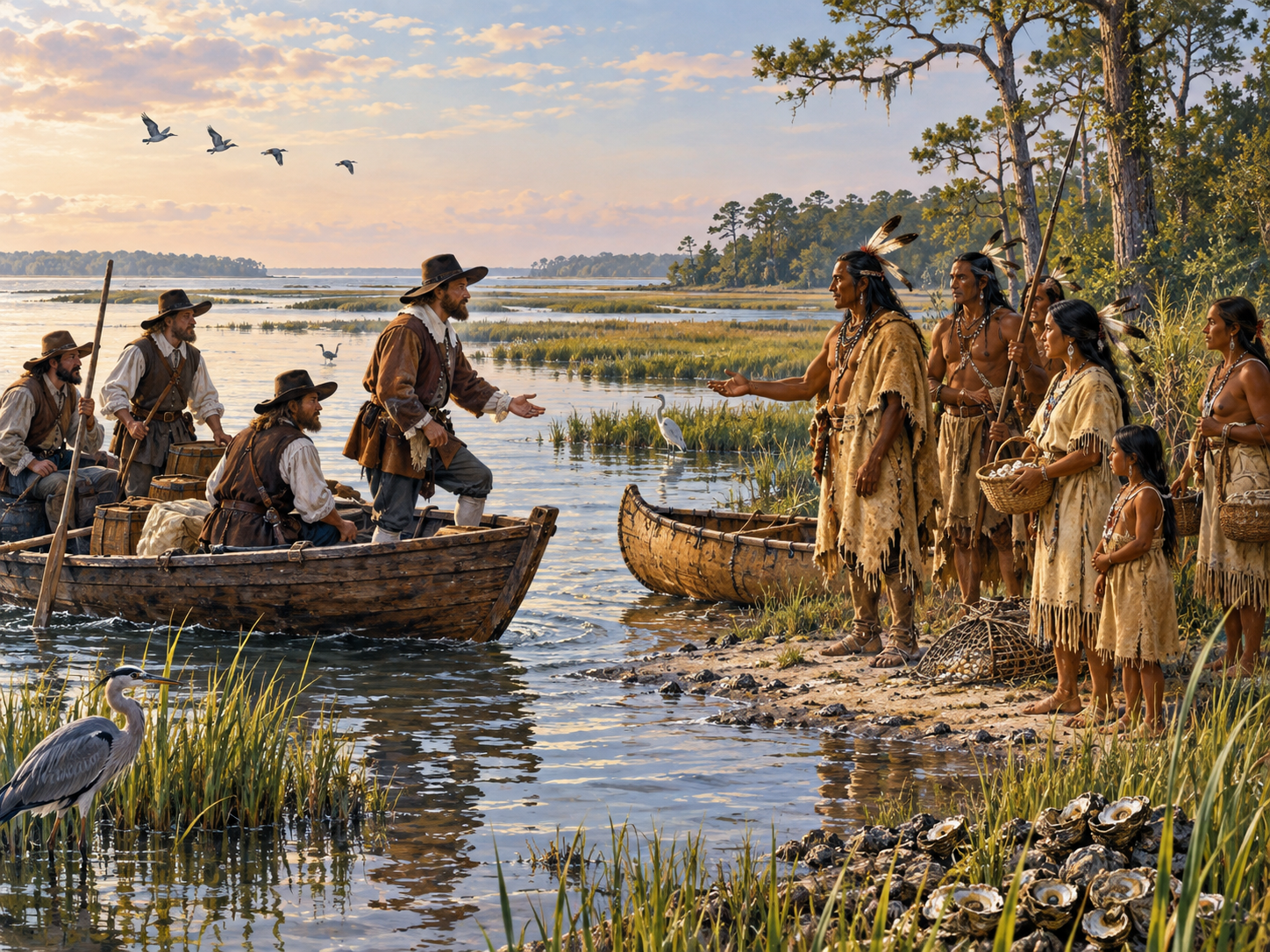
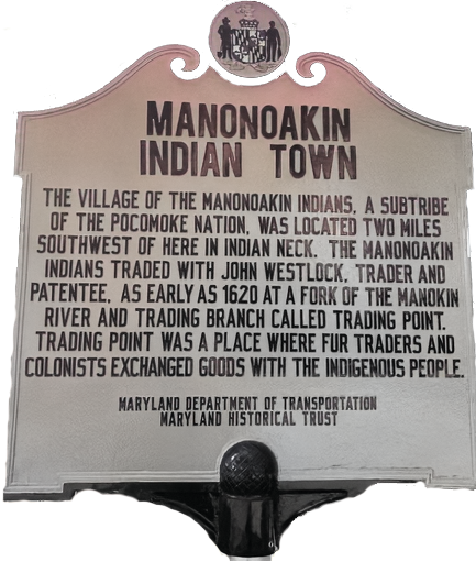 which supplied them with food. Many trails were made across the marshes while trapping for muskrats, hunting deer and wild foul. They also searched the forest for sassafras trees where its roots were used to brew a tea which they drank as a spring tonic to thin their blood. The names as we know them such as the Wicomico's, Manokins, Nanicokes, Choptanks, Pocomokes, etc. were given to them by the white man. These names were associated with the rivers in which they lived on or near.
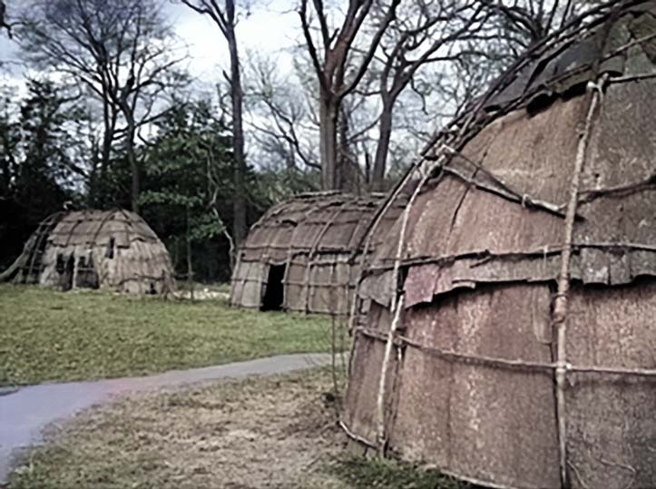 north side of a Creek known then and now as Back Creek. An Indian town was located in a fork, between the Manokin River on the north and a branch on the south side of the river called Trading Branch (AKA Mumford’s Branch and today King’s Creek). This area of Old Somerset County, Maryland was a well-documented trading post for early Europeans and the Indigenous people of the Eastern Shore.
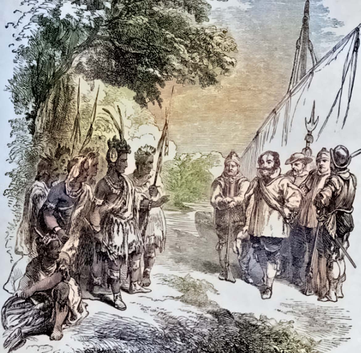 Records from 1620 recount a trading session between the Manokin and visiting Europeans at an Indian village along the south bank of Manokin Creek in what is now Princess Anne. It should be noted that while Captain John Smith was welcomed at various locations and traded with the Indians that not all welcomed John Smith as the Englishmen, the white man on many occassion were greeted by flights of arrows from the tree tops.
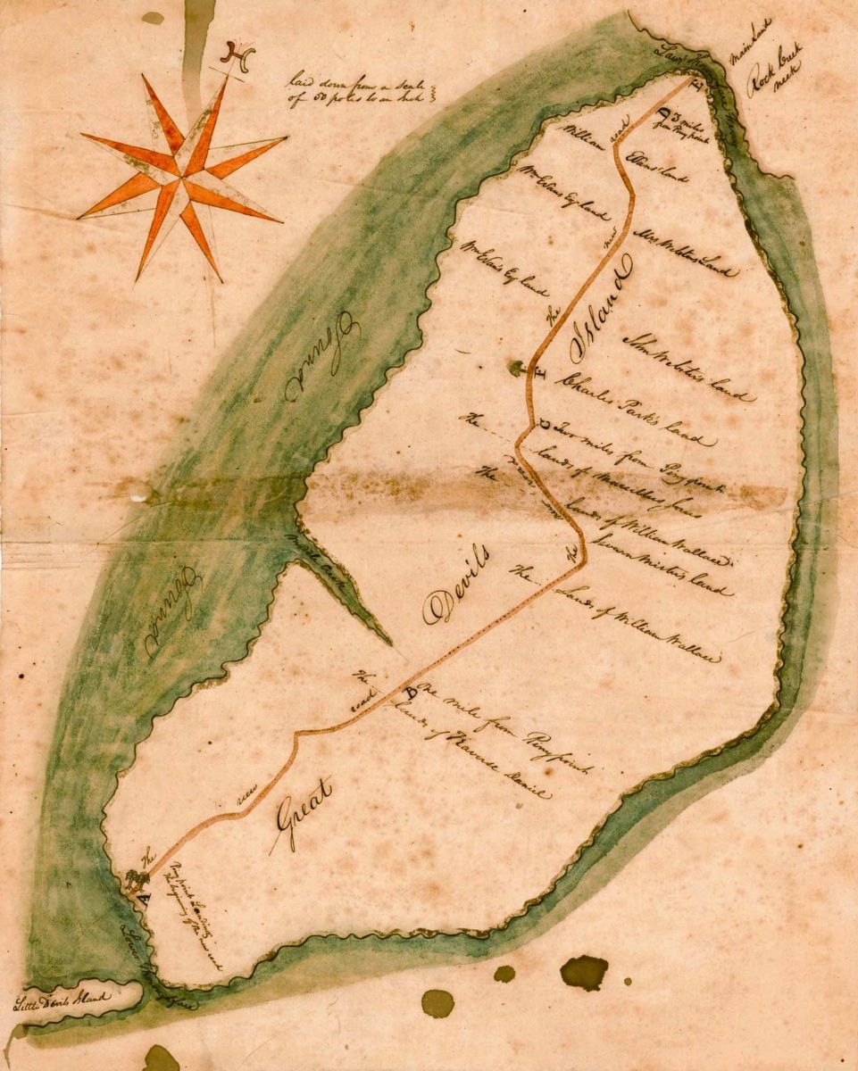 He came from Scotland and settled on the Island. He was a lover of the sea and a very energetic man and by the following year of 1677 he had bought part of North Foreland from Thomas Roe. In a short time, he also obtained part of the Bradshaw purchase. He divided his land into building lots and then sold to settlers. He envisioned a great future in the seafood business and encouraged the waterman to sell not only their catch of fish, but their oysters and crabs as well.
 24 October 1824 Travis Daniel a wealthy planter from North Carolina purchased from Robert J.H King part of the tract on the lower end of Devil’s Island (Wenona) known by the name of Self Preservation for which he paid the sum of one hundred, twenty-five dollars. For several years he farmed the land and later began selling building lots to new incomers encouraging them to settle on the lower end of the Island.
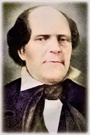
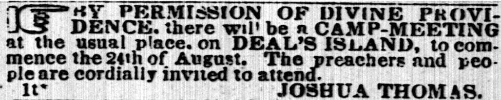 It was 17 July 1828 where Joshua Thomas (click link to see more on Joshua Thomas) started holding his famous Camp Meetings on Deal Island. Thousands from all around came by large and small sailing boats to hear his fiery sermons. In 1850 a new church was completed near the camp ground where the land was donated by Captain John Parks and his brother Charlie. This became known as the
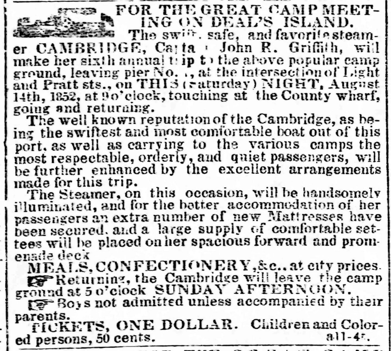
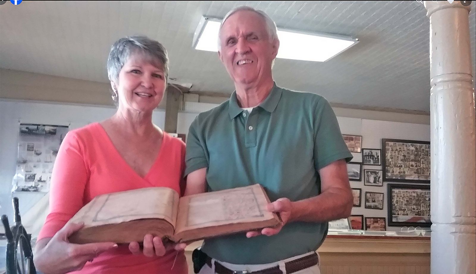
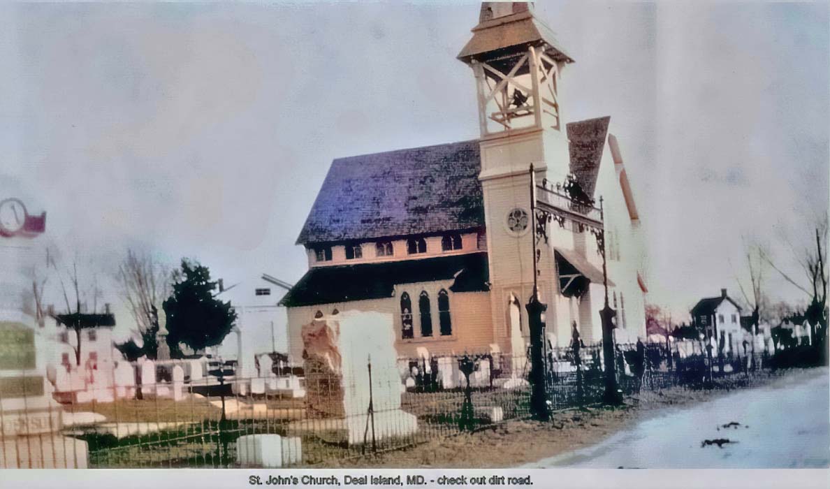 In 1879 a new larger church was built in front of the Joshua Thomas Chapel on Deal Island. The people of the Island also attended Rock Church before their own church was built. Later, two other Methodist Churches were built on the Island. One at Wenona and the Deal Island Church for the colored population. I, myself (author and website administrator) can attest to the Methodist influence of the area as my own name Wesley comes from my family living there.


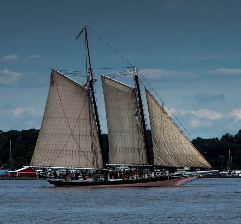
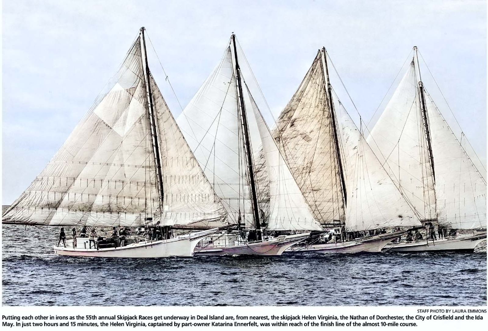
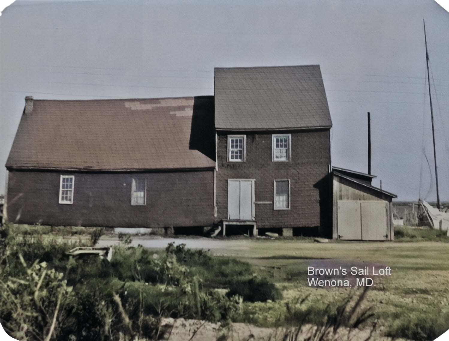
 started scheduled trips when the

 By the 1900’s strawberries, beans, potatoes and tomatoes fresh and canned were being shipped in large volume to Baltimore. There were also shipments of chickens and cattle. Albert Anderson, son of founder of the Anderson Hotel recalled seeing 500 crates of strawberries from the Bradshaw farm being loaded one day and they were the large crates holding 32-48 or 60 quarts.
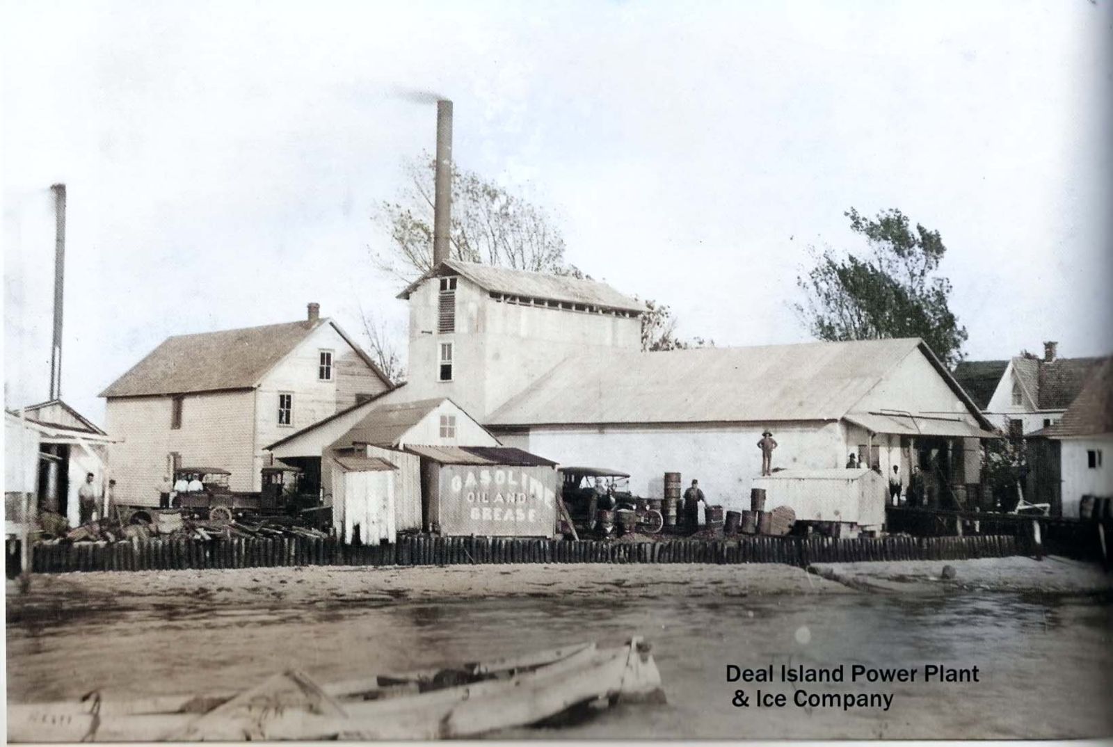 On the pier an icehouse was operated by Adophus and Ralph Brown. On the waters edge to the south of the wharf another ice plant was started in 1916 by Thompson Wallace. Near this plant Harry Wilson opened the first garage in the early 1920’s then later built a new garage and Ford salesroom, which is now the Firehouse (1970).
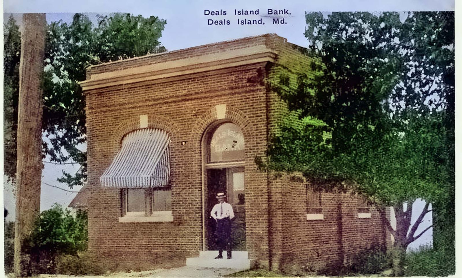 Some years later a new bank was built, a branch pf the Bank of Somerset with Arthur Andrews as cashier and Edelen webster as assistant cashier, This bank closed in 1929 (Stock Market crash).
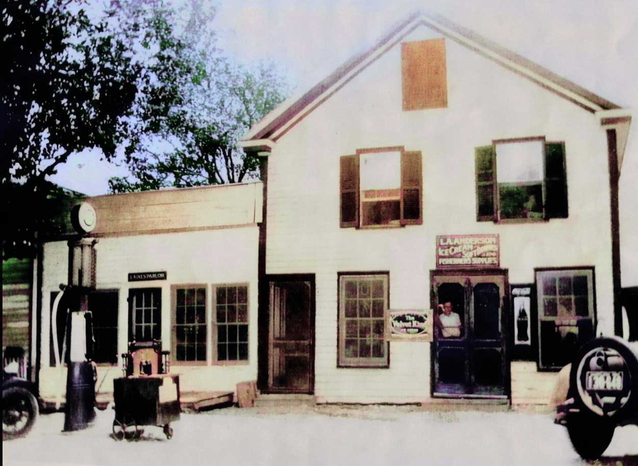
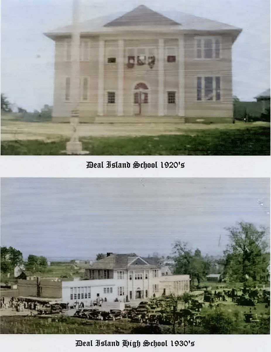 matches that drew many customers from the mainland. There were ice skating parties and taffy pulls in the wintertime and lawn parties in the summer where the lawns were elaborately decorated with Japanese lanterns where homemade ice cream was served for refreshments. Life was pleasant, a few young people wanted to leave their Island homes for metropolitan living.