| DEAL ISLAND WEATHER |
| Web Counters | ||||||
|

|
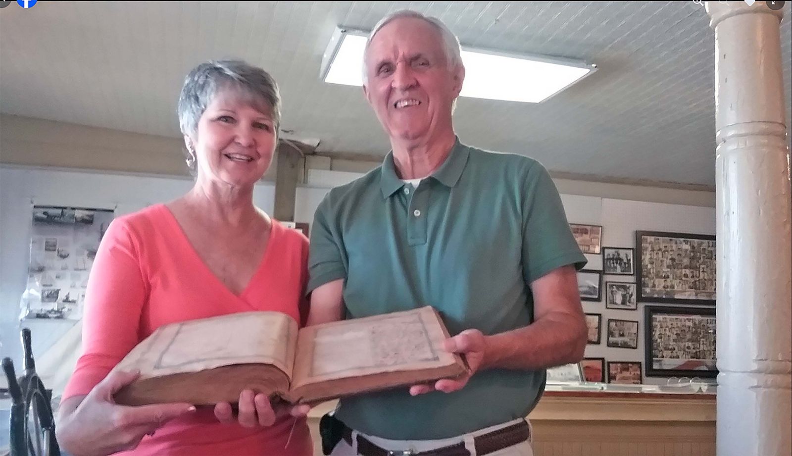
- Written by Skipjack Heritage -
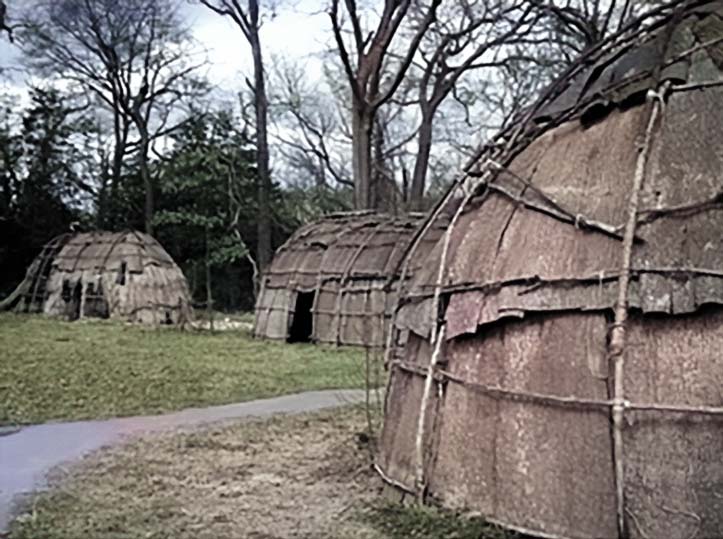
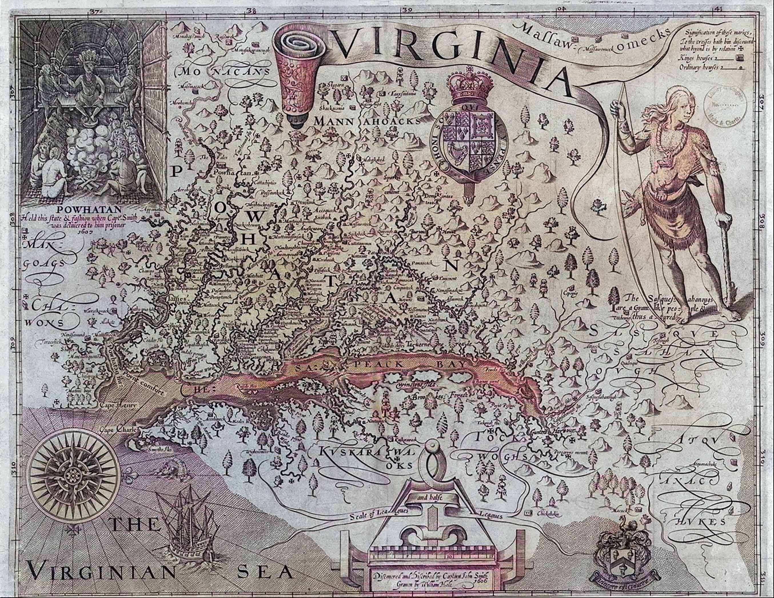
Years before the white man came to the Island it was known to be the Indian country of the Manokin Tribe. Their wigwams lined the shore and their canoes skimmed the waters of Tangier Sound. They loved the creeks and the forests, both of
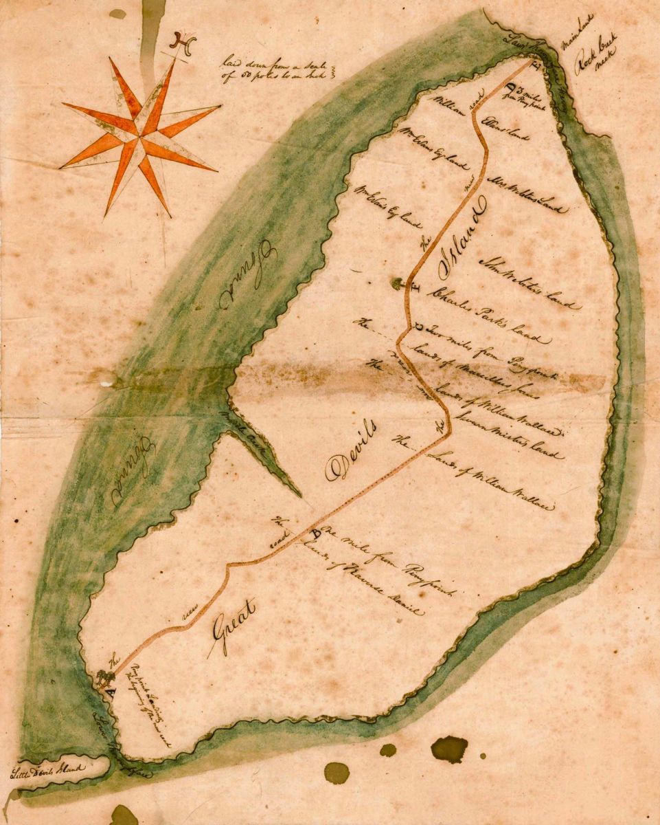
The Manokin Indians were a sub-tribe or band of the Pocomoke Paramountcy and were located in a Neck known as Arrococo by the native people and later called Revel’s Neck (see Randall Revell, 1613-1686/7). This area is best described as the lands on the south side of the Manokin River and the The deposition of several residents and visitors to this area paint a picture of the trading on the Manokin River water shed. "John Westlock" states that he was trading with the natives in Manokin as early as 1620. In 1666 Westlock received a patent from the Calvert’s called Brownstone, located on the north side of the Manokin River just to the north of Trading Branch Fork. Early settlers were Stephen Horsey, Ambrose Dixon, Randall Revell and eventually many others including John Evans at Smith Island named after Henry Smith who patented the 1,000 acre plantation called "Pitchcroft" on June 3, 1679. The first white man who had the first land grant in the area that became "Deal Island" was issued to John Laws in 1676. The official communities were first known as "hundreds" as was the tradition back in England. Many relics have been found on the beaches and in tilling the land. Arrowheads, hatchets, necklaces and bracelets made from tiny shells, broken pieces of pottery all tell the story of Indian life on the Island. There is mute evidence of an Indian village on land which later became the farm of William White. The winding road from Wenona to Deal Island village is known as the old Indian trail. It’s many curves tell the story of how on foot they picked the high spots across the marshlands.  As early as 1607, in the history of Captain John Smith’s first voyage of exploration of the Chesapeake Bay he states there is but one entrance by sea into this Country and it is at the mouth of a very goodly Bay, 18 to 20 myles broad........ He crossed from the new settlement of Jamestown to the Eastern Shore (Somerset County) and after several adventures discovered what was called at the time "Russell Isles (Tangier, Smith, Hollands, South Marsh, Bloodsworth, etc.) and named after the doctor (Dr. Walter Russell) that accompanied Captain John Smith on his voyage, where they saw many creeks, rivers and islands. The early settlers found the Indians raking oysters from the bottom wherethis tradion still continues today. Many islands were noted where among the largest were Tangier Island, Smith, Deal and Holland Islands. Captain Smith mentions in his writings that [Deal] the Island was one of his prominent landmarks as he sailed around the Bay (and would later search for any living from the Roanoke Colony). Several years passed before three ships were manned to venture across the ocean. All went well until they reached the Chesapeake Bay and ran into a hurricane. Two of the ships were fortunate enough to reach Accomac(k), Virginia, but one was driven off course in Tangier Sound, its sails ripped, mast broken and most of the crew lost. Those that survived wereleft to the mercy of the storm. In the darkness of the night their ship was blown ashore and wrecked. When morning came and the wind and rain had ceased the survivors looking across the rough waters of Tangier Sound while turning to the land to see nothing but marsh and wilderness, cried out in their distress, “this is purgatory is the land of the Devil.” It was this same storm that cut a wide channel separating about thirty acres of land from the lower end of the Island, which was later known as “Little Deal’s Island.” Starting out across the marsh these ill-fated survivors were met by Indians who had sighted their ship. At first the Indians were not very friendly, fearing they were pirates who had come to hide out on their Island. However, the white men soon convinced them they meant no harm, only wished to be friends and thereby welcomed to their village. It is said that for more than a century the [Deal] Island was known as Devil’s Island and was used by pirates as their hideout. Details including any date and landing of the ship, names of survivors have vanished over time. The only proof that we have this is not a fictional legend, but a true story is the record in the County Clerk’s office of a deed for Purgatory. While a specific exact date for the first individual settlement is not widely recorded, historical accounts indicate that families of English descent were establishing communities on the peninsula by the mid-to-late 17th century, with some tracing their ancestry to the early settlements in the 1600s. One local account suggests the first settlement in the immediate area might have been a place called "Pidgeon House" around 1632.
Deal Island as also known as "Devils Island," Deils Island, Deals Island and its present form of Deal Island today, which we can thank the government. The first land patents on Deal Island village in Somerset County were Christopher Oldsfield, Lloyds Grove and Cowley; Patents to Thomas Roe, North Foreland in 1676; Rent Roll. [William] Bradshaw purchased part of Lloyds Cove and Cowley in 1665. Land Patents to Robert King on the lower end of the Island (Wenona) are as follows: Self Preservation/1745, Support/1744, Barbodeas/1725. John Lawes was the first white man to receive a grant in 1676. In a brief time, small boats were carrying oysters to nearby towns and villages. The larger (sailing work) boats began loading oysters and crabs for Baltimore. This started the seafood industry on the Island where Deal Island, Crisfield, Smith Island, etc. were major exporters of seafood to Baltimore. The Channel which separates the Island from the mainland was named “Lawes Thoroughfare” in honor of John Lawes. [Colonel] Robert King owned about 300 acres of tillable land and 200 acres of sand and marsh on the lower end of Devil’s Island, however there is no record of him ever living there. He deeded his land patents to Robert J.H. King and Nehemiah King. On 24 October 1795, David Wallace bought from Nehemiah King 70 acres of land called Support for 116 pounds, 16 shillings and 3 pence. Several years later he bought the patent Barbadoes. Wallace was the first local preacher on the Island and was ordained as Elder. He solemnized the majority of marriages in his own home. His old home was the first place opened for religious worship on the Island. The original house burned, but Captain William Price (Customs officer of the port) bought the land and built a home there which became the home of Mr. and Mrs. Eddie Shores. At the time tobacco was the principal export and later wheat and other grains were shipped to England and the West Indies where returning boats had cargoes with household goods.While northern colonies were largely in favor of waging a war of Independence against the british crown, support never swelled in Somerset County, especial in lower Somerset being the Deal Island area, Smith Island where the tory pirates Marmaduke, Stephen Mister, John Evans, Joseph Wheyland and other loyalists terrorized the lower Bay, shore area in the late 1770's. This all led to the last battle during the Revolutionary War at Kedges Straits called the Battle of the Barges in 1782, lower Somerset County. A few of the names prominent in Island history before the Revolution were William Bradshaw, Thomas Roe, Robert Rowe and John Lawes. Others coming during the Revolution were Tyler, Evans, Crockett, Parks, Mister and Thomas. These people were of Anglo-Saxon, Welsh origin, self sufficient and self centered developing their own habits and traditions. On The most prominent arrival in the first half of the 19th century to the Island came from Tangier Island. He was the preacher Joshua Thomas, the Parson of the Islands born 1776 in Potato Neck [married to Rachael Evans from Smith Island and after she died in 1797 he married Charlotte Bradshaw]...........(Baltimore Sun 1955 newspaper article) who had warned the British army who occupied a base at Tangier Island they would be defeated at Baltimore where the British General Ross gave him his title of "Parson of the Islands." Joshua Thomas standing before 12,000 British troops tried unsuccessfully not only ministering to them, warning them and taking care of his own congregation, local residents. With his brother in law Aaron Bradshaw, he purchased Little Deals Island and named it “Little Eden.” After the death of Aaron Bradshaw, Solomon Evans a wealthy planter from Smith Island bought his home and lived there for many years. Joshua Thomas apprenticed with fisherman David Tyler of Smith Island where he honed his boating skills and learned about Methodism. Brother Thomas was ordained as the Deacon of the Church where on the passing of David Wallace became his successor as local preacher on the Island and who mostly single handly caused the movement of Methodism in the area. He and his family moved to Deal Island from Tangier Island about 1825. Joshua Thomas founded an annual Methodist camp meeting in Deal Island at Old Hill starting in 1828. The people of the Island gave him a canoe where he named it “Methodist.” It was constructed out of one log, had a length of more than 20’, a beam of about 5’ (that was a big tree!) It was at a prayer meeting at the home of Captain John Parks where one of the visiting ministers suggested that they change the name from Devil’s Island to Deil’s Island stating that Deil was a Greek word meaning devil. The map issued in 1870 shows the Island as Deil’s Island vs. Devil’s Island.
By the late 1850's the Underground Railroad helped some slaves escape north through Deleware, few obstacles in the way once they passed the slave agents in Seaford. Several Somerset homes possible including the Teackle Mansion allegedly had connections with the Underground Railroad. Many Somerset slaves were given small parcels of land on which to grow their crops or raise chickens. In reality slave rebellion in Somerset County was not marked by violence. In 1862 the (Union) US Navy staffing the Bay with the gunboat Hercu. This boat captured several Deal Island based ships/boats that had smuggled goods to Confederates including the Algonquin and Chesapeake. A third the Victory was captured off the coast of Virginia and burned. Hidden Chesapeake: Slavery and Freedom through Harriet Tubman's Eyes
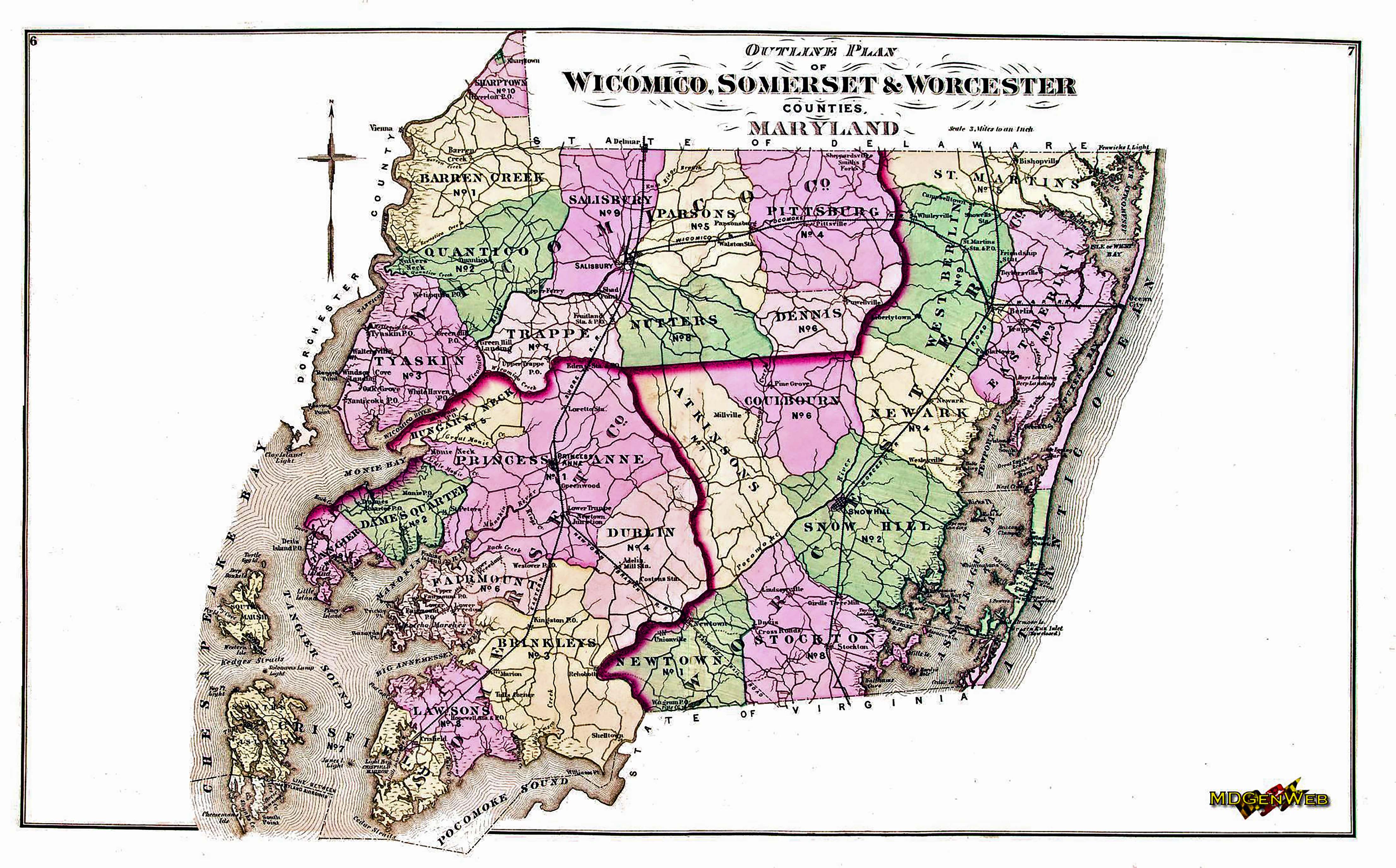
Folk medicine and home remedies that were passed down from generations were the health care of the period for the Island’s population. It was a tight knit community where neighbors and family supported the sick. Historical accounts suggest the Islanders simply built-up immunities to some local ailments over time. The diseases that affected Islanders were the norm for the time malaria, smallpox, typhoid, measles and diphtheria. The mosquitoes from the marsh, unclean water were major causes. Child birth was challenging as well for the period. The population of the Island in 1850 was about 500 souls, which was a steady increase from the earlier settlers. The families took great pride in developing the Island. New roads were (of course) built with oyster shells, new homes appeared along the roads where horses and carriages were now used to supplant the previous method of traveling by horseback. 1877 Atlas Map of Somerset County Until 1878, when the steamboats arrived practically all transportation away from the Island was by boat. There was a rough road over a circuitous route leading to Princess Anne the County Seat. After leaving Chance it led to the south through Oriole, Dames Quarter, St. Stephens and part of Venton. It was full days trip with a horse and wagon and a very difficult one at that. The rain and snow made it treacherous where in the summer mosquito’s made it even worse. Early access to the Island was by ferry, but in the 1800’s a bridge was built and in the early 1900’s a more substantial, sturdy bridge was constructed that crossed the Thoroughfare.
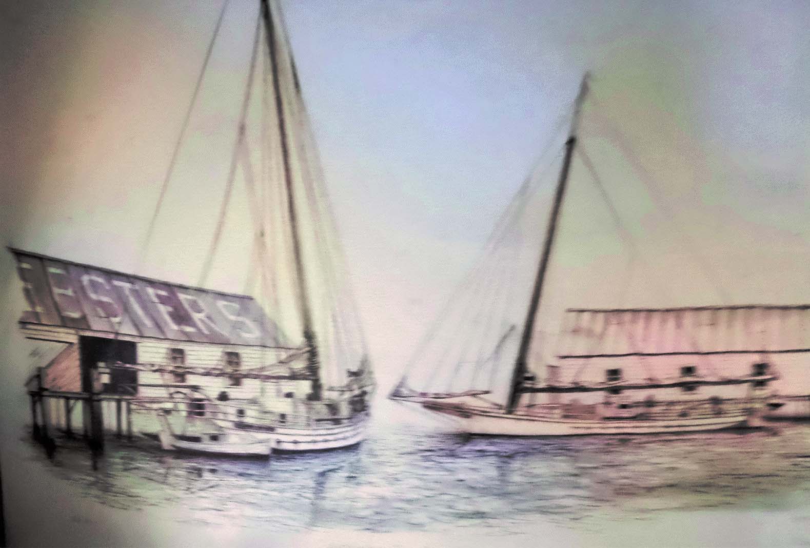
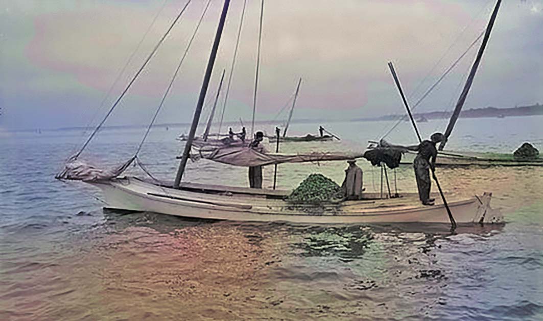
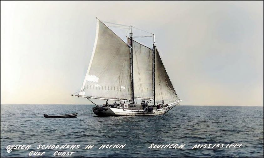
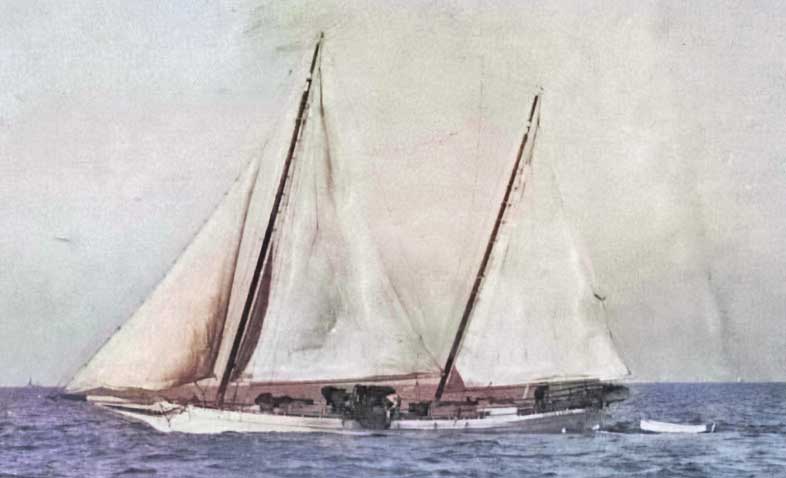
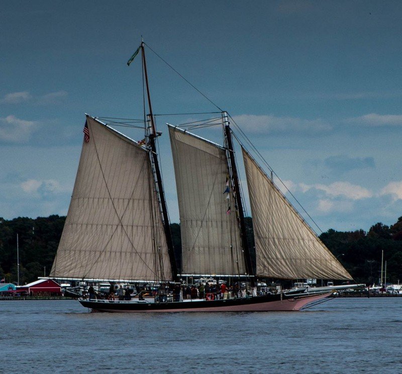
Prior to this time there was some farming on the Island, but the inaccessibility of accessing good markets limited production. The majority of the Islanders earned their income from working the water. Oysters, crabs (including soft crabs), fish were harvested with small boats, sloops, schooners and then the Bugeye and the Skipjack. Oyster drudging was generally the most lucrative, better then hand tonging. Seafood was an important item in the diet and housewives, their families salted away fish for the off-season meals.
Larger sailboats were used not only for harvesting seafood, but for carrying it to the Baltimore market. In the early days settlers used dugout log canoes carrying sails and then came the plank type built boats with greater holding capacity. Ultimately there were mostly 3 types of sailing boats used by Deal Island waterman, which our own Roland Parks was a great source of information as well as he made model boats/ships.
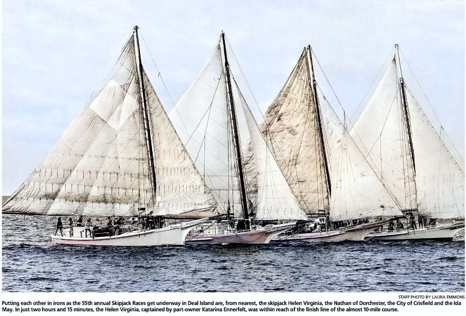
There were of course variations of the different types. Some Skipjacks were built on Deal Island, in two boatyards- one on the northern end and one on the lower east side in what is known as the Creek. The Skipjack was developed in the 1880’s where the largest of its kind was the “Robert L. Webster” built in 1915 at Oriole. At the time of this writing she was under the command of Captain Eldon Willing, Sr.
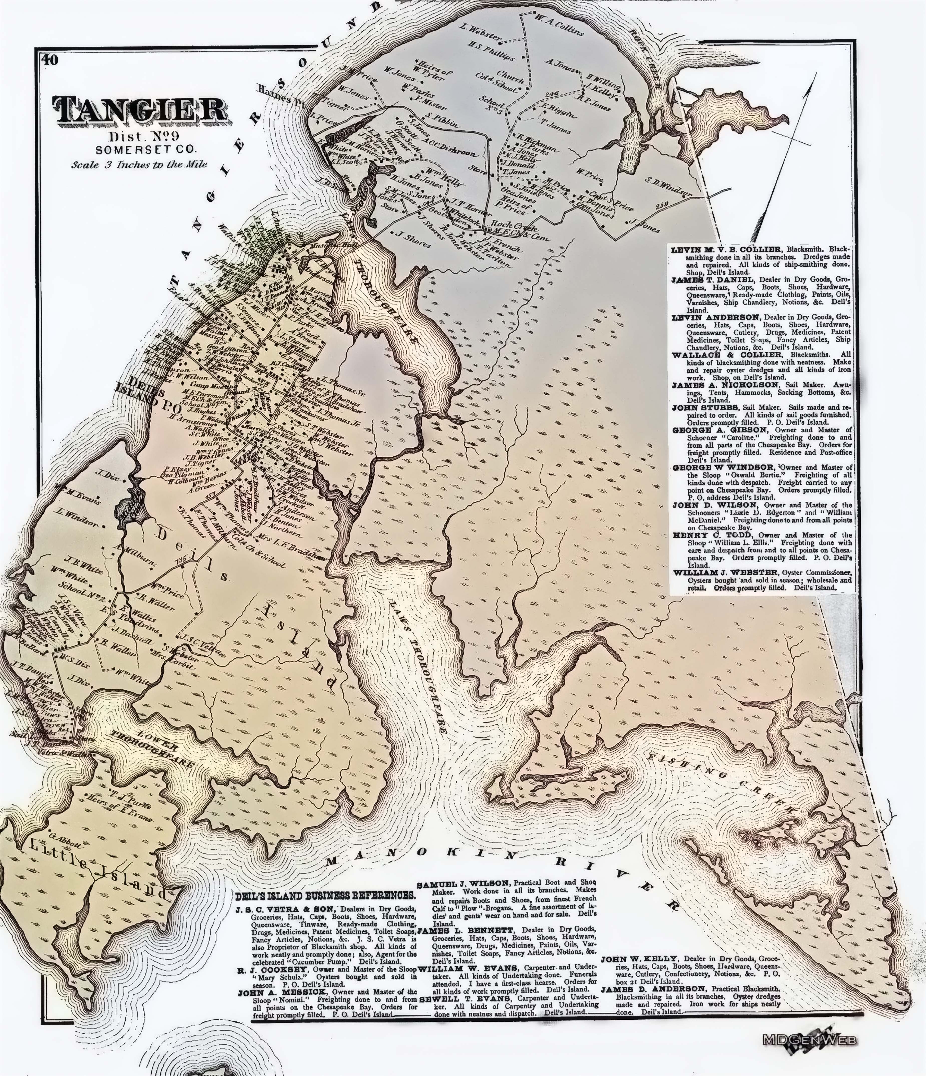
A map of Deil’s Island issued in the 1870’s lists the advertisements of five General Stores- James T. Dashiel and J.C.S Vetra and Son at Wenona, J.T. Bennett and Levin Anderson at Deil’s Island Village and John R. Kelley on the east side. You name it and they sold it: dry goods, groceries, medicines, clothing, paints, cutlery and so on. Samuel J. Wilson was a shoe and boot maker, William Evans was a carpenter and undertaker, Sewell Evans did carpentry and undertaking as well. Captain Levin Collier at Wenona and Captain William Webster from Deil’s Island were Blacksmith’s. They made and repaired dredges (drudges), anchors, tongs for boats, shoes for horses, andirons to keep the home fires burning for the watermen and his family’s where theirs was an important By 1878 the days of traveling by sail exclusively came to an end when steamboats
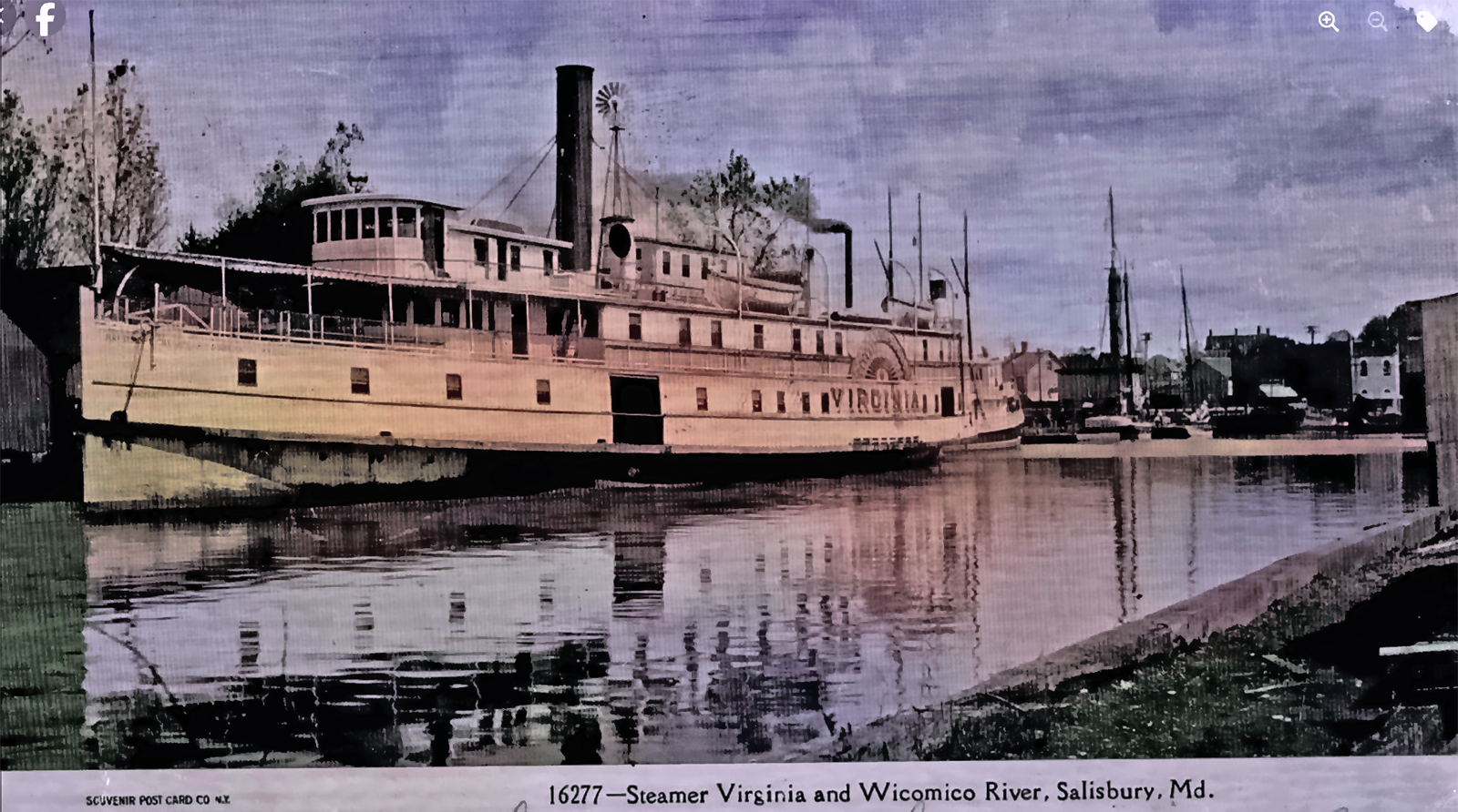
The Tangier and Virginia started in 1878 running from Salisbury to Baltimore with stops at Deal Island at 6:00 PM daily except Saturdays. On the return trip from Baltimore the boat would arrive at the Island at 3:00 AM. A Post Office was installed on the wharf called Soundside Post Office and Mrs. Ralph Brown was the post mistress. Meanwhile a Post Office had been located in Wenoma. The settlement Wenona originally bore the Indian name of Wennoah, but the government changed it to Wenoma. Captain Bill Anderson for many years picked up the mail from the Wenoma and Deal Island Post Offices and delivered to the pier to be taken to Baltimore by boat. During this time mail was also received from Princess Anne by team and buggy.
The steamship wharf became the focal point for most of the Island’s activities, both commercial and social. As one came off the pier around the turn of the century one would see on the right the Anderson ship chandlery and shipyard. On the left was the Anderson Hotel, which was the largest and most popular within a large area. With the main house and two smaller buildings it could accommodate 85 guests. It was the stopping place for commercial travelers and tourists. Its guest list contain the names of many prominent people from metropolitan centers who came here to fish and hunt. The availability of steamship service to metropolitan markets brought many acres of the Islands soil into production. The shipping of seafood of course became the major operation. With the development of the internal combustion engine many small boats so equipped could greatly increase the tonnage of harvested crabs. Oyster and crab packing houses were set up all over the Island. Soft crabs were shipped in large boxes packed with seaweed, hard shells in barrels and oysters in the shell went out in baskets with shucked oysters being picked in small kegs. Near the old hill was a fishery plant which canned herring and shipped out salted fish in barrels. These shipments were not were not for Baltimore alone, but were transshipped to other markets on the East Coast and even the middle West. With a large production of tomatoes 2 canning plants were built: one owned by Noah Webster between the Old Hill and Hunts Creek. The other was at Wenoma where Harry Wilson’s oyster house was located, also owned by Thomson Wallace. The first motorcar, automobile was owned by Henry Brown the sailmaker. It had a chain drive and a rod for steering. Noah Webster who had moved to Baltimore, but stilled maintained a second home on the Island also owned an automobile at the same time. After about a quarter of a century of steamboat service the Islanders began to realize what a great improvement had come over the economic situation on the Island and became enthusiastic about the future. One of these enthusiasts wrote the Princess Anne newspaper in 1895 as follows: “We are still surrounded by water – as we have always been – but we are rising rather than sinking and Deal Island once known as Devil’s Island bids fair to be one of the most thriving places on the Shore. Wait and see.” In the same year there was a movement to build a railroad to Princess Anne. The steamboat company offered $1,000.00 toward financing it, but apparently there were not enough other subscribers. The first bank on the Island was in the store of William Seymore Thomas, grandson of the Reverend Joshua Thomas. There was a change in family activities with the coming of the steamboats as well. The women began to travel to Salisbury and Baltimore to do their shopping and the homes of the watermen showed the effects of wider selections for their furnishings including victrolas, linens, china, furniture and so on. Many fine homes were built during this era. Entire families would go on excursions to Baltimore; meals were good and fine sleeping accommodation. Captain Johnie Bennett met all the boats first with horses, carriages and later with his Dayton automobile. He transported passengers and delivered freight. He also owned a stable of fine race horses which he entered in some local events. There were still the General Stores of sailing days, but now more service facilities and amusement enterprises appeared. The Anderson store on the wharf road sold groceries and boat supplies on the first floor and on the second floor Mrs. Anderson had a millinery shop and sold dry goods.
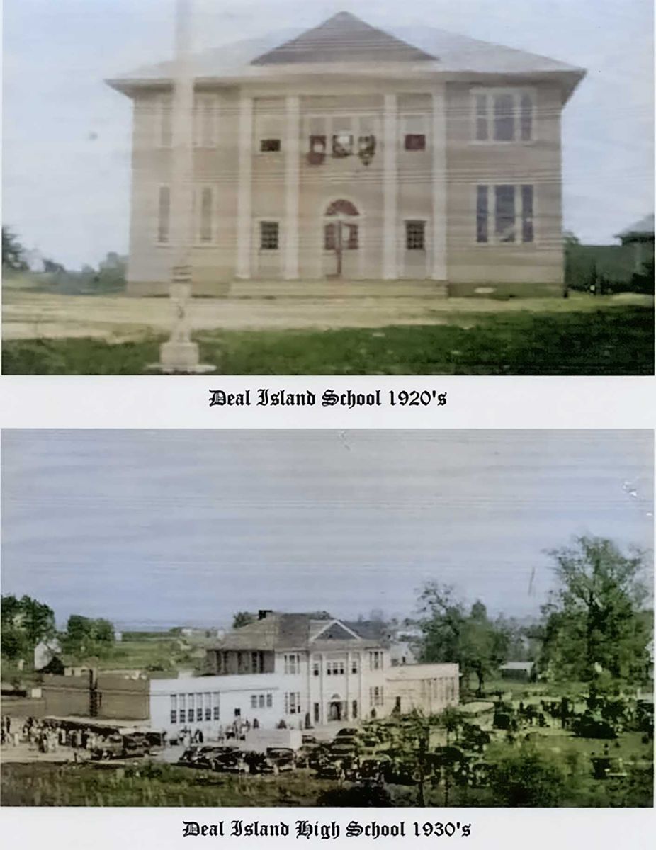
Thompson Wallace owned a department store where Melvin White lived. It was a two story building where anything the family needed could be found. On the main highway near the ice plant was a large store owned by Fred Webster and his father. There were many other small stores throughout the Island that sold groceries, candy and ice cream where some were called ice cream parlors. Mrs. Theresa Thomas affectionately known as Aunt Teas owned the drug store and operatedan ice cream parlor where you could buy a big bowl of handmade ice cream for a nickel. Mr. Charles Ringgold had a complete haber dashery store where Mrs. Lottie Shores lived. In 1914 The Diamond State Telephone Company opened an office and Mrs. Eva Shores was the exchange operator with the office in her home. In 1928 Mr. Thomas Price established a bus line that ran from Wenoma over the rough marsh roads to Princess Anne and then to Salisbury. A Model T Ford was made into a bus capable of carrying twenty passengers. Mrs. Mollie Wallace Lively for a number of years, taught an art class in oil painting where many of the homes in the 1920’s had her and student paintings. Recreation took different forms on the Island. A skating rink and a pool room were located to the right of the home of Mrs. Kate Anderson, owned and operated by W.O. Brown and John Bennett. Wenoma had two movie houses, a skating rink and a merry-go-round. A Red Men’s Hall with a large auditorium for social events was situated near the Deal Island School. In the early 1900’s an amateur theater group gave plays in the sail loft at Wenoma. In the early 1930’s there was an arena for boxing In 1916 the high school was in trouble. Only eleven students had enrolled for the coming year and Mr. William Dahiell the county superintendent, told the teachers unless they find forty pupils the school could not open. Mrs. Elizabeth (Anderson) Bozman realized what it would mean if the high school closed. She talked to Mr. Dashiell who gave her little encouragement. She explained the need to the State Supervisor in Baltimore and solicited the help of Mr. Joshua Miles, the leading politician in the county who had many friends on the Island. Together they spent many hours with the parents stressing the importance of a high school education for their children. By the last week of August, Miss Lizzie as her pupils called her, had forty-one students enrolled. The Deal Island school opened on time. |

 north side of a Creek known then and now as Back Creek. An Indian town was located in a fork, between the Manokin River on the north and a branch on the south side of the river called Trading Branch (AKA Mumford’s Branch and today King’s Creek). This area of Old Somerset County, Maryland was a well-documented trading post for early Europeans and the Indigenous people of the Eastern Shore. It appears that English settlers from the Colony of Virginia were visiting this area long before the county of Somerset was formed, or the Colony of Maryland settled. The best evidence of this fact is recorded in Somerset County Judicial Records. Most of the settlers of this area came from Virginia's Eastern Shore after 1660.
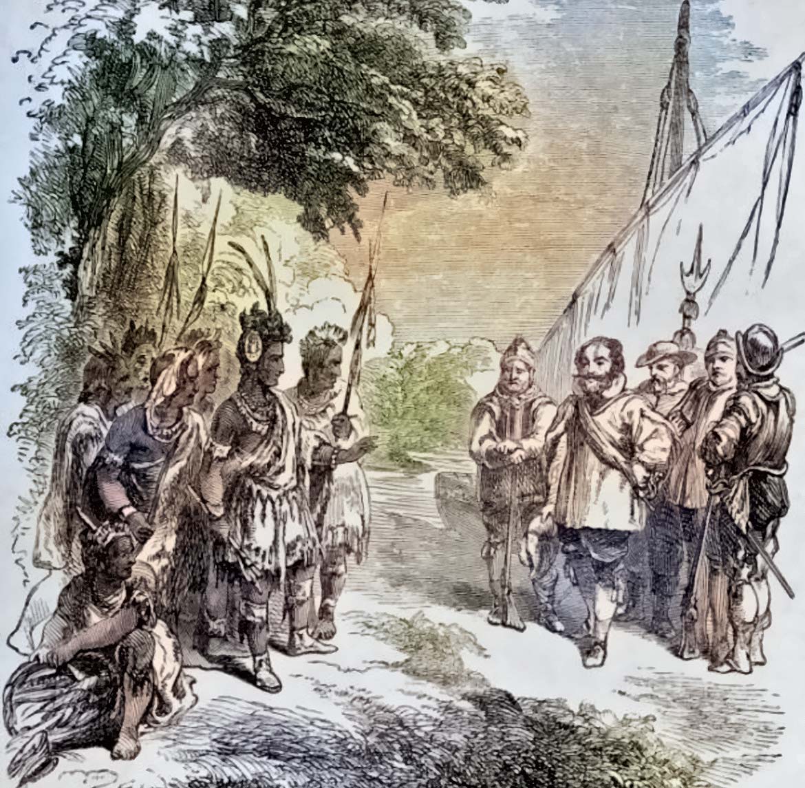 Records from 1620 recount a trading session between the Manokin and visiting Europeans at an Indian village along the south bank of Manokin Creek in what is now Princess Anne. It should be noted that while Captain John Smith was welcomed at various locations and traded with the Indians that not all welcomed John Smith as the Englishmen, the white man on many occassion were greeted by flights of arrows from the tree tops.
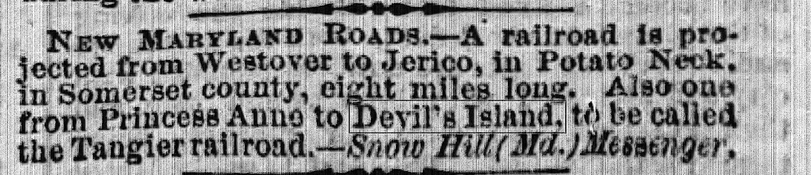
 He came from Scotland and settled on the Island. He was a lover of the sea and a very energetic man and by the following year of 1677 he had bought part of North Foreland from Thomas Roe. In a short time, he also obtained part of the Bradshaw purchase. He divided his land into building lots and then sold to settlers. He envisioned a great future in the seafood business and encouraged the waterman to sell not only their catch of fish, but their oysters and crabs as well.
.jpg) 24 October 1824 Travis Daniel a wealthy planter from North Carolina purchased from Robert J.H King part of the tract on the lower end of Devil’s Island (Wenona) known by the name of Self Preservation for which he paid the sum of one hundred, twenty-five dollars. For several years he farmed the land and later began selling building lots to new incomers encouraging them to settle on the lower end of the Island.
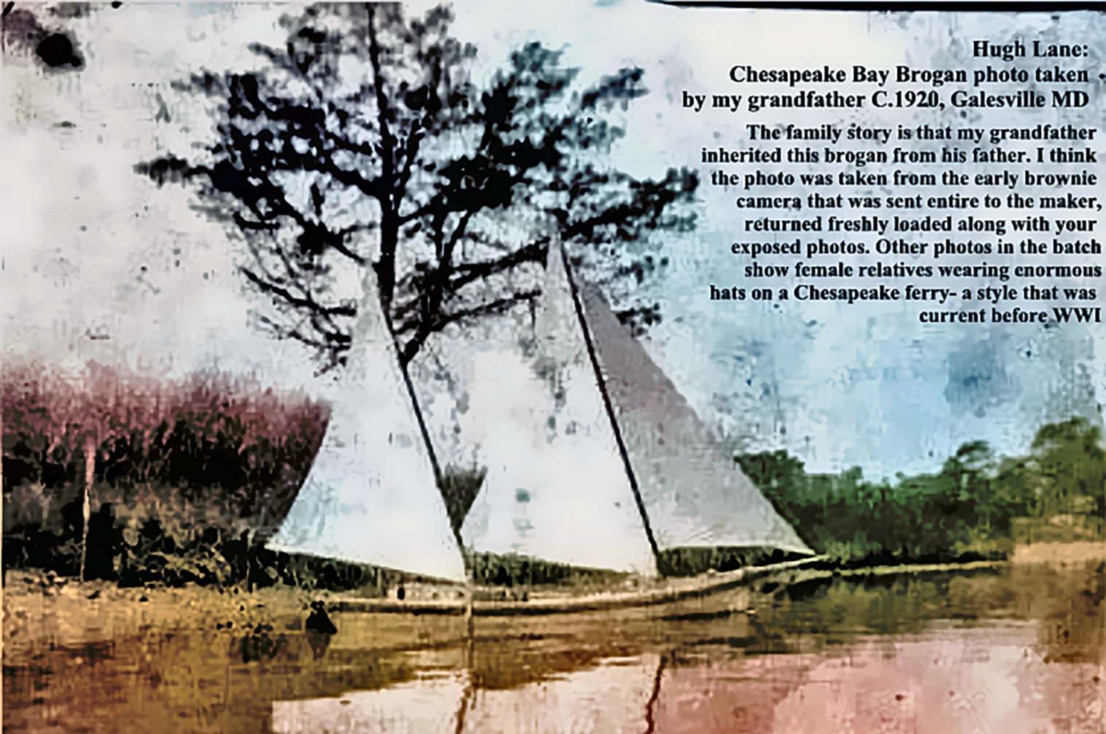
24 October 1824 Travis Daniel a wealthy planter from North Carolina purchased from Robert J.H King part of the tract on the lower end of Devil’s Island (Wenona) known by the name of Self Preservation for which he paid the sum of one hundred, twenty-five dollars. For several years he farmed the land and later began selling building lots to new incomers encouraging them to settle on the lower end of the Island.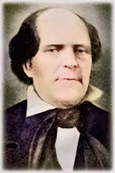 and carried 2 masts. The log canoe was a forerunner of the Chesapeake Bay Bugeye.
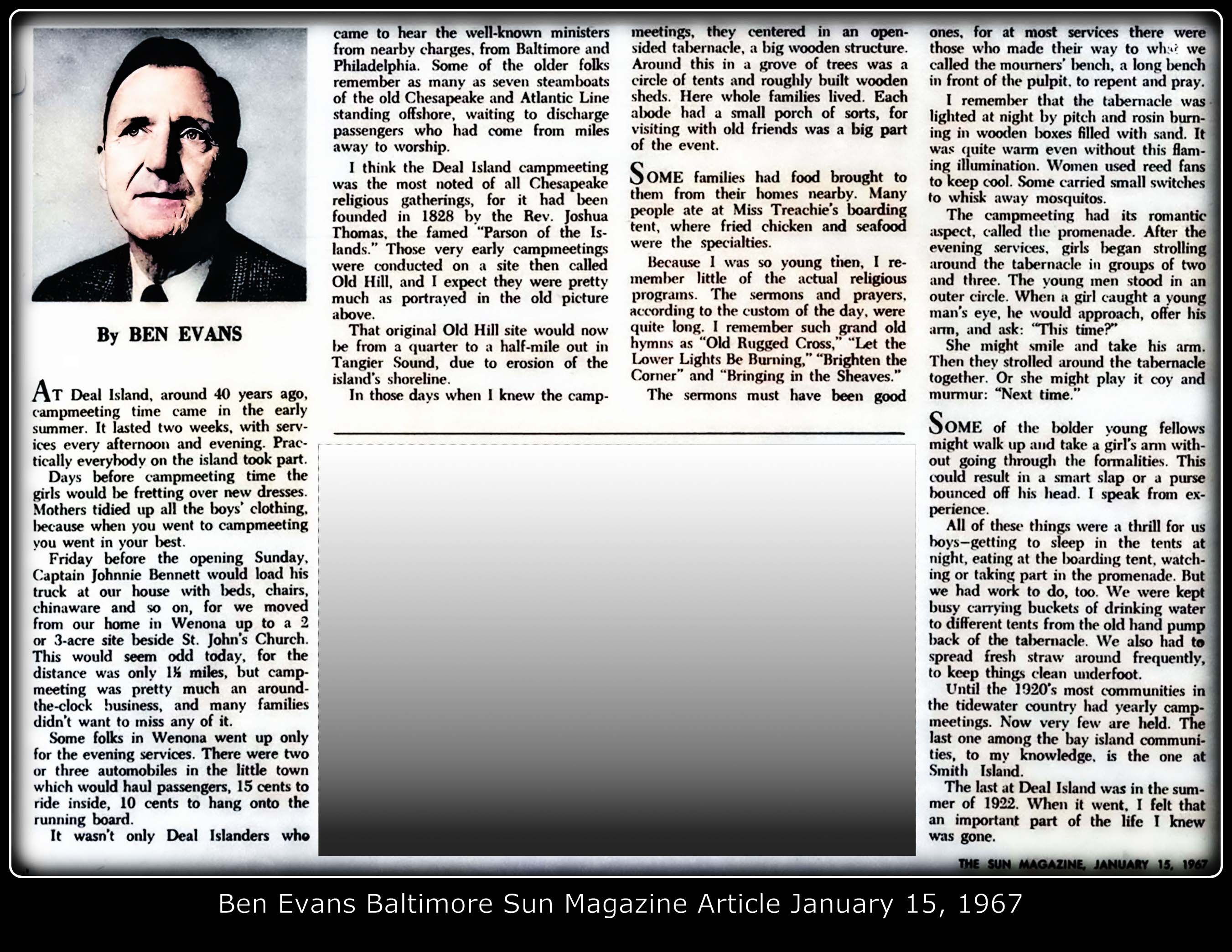
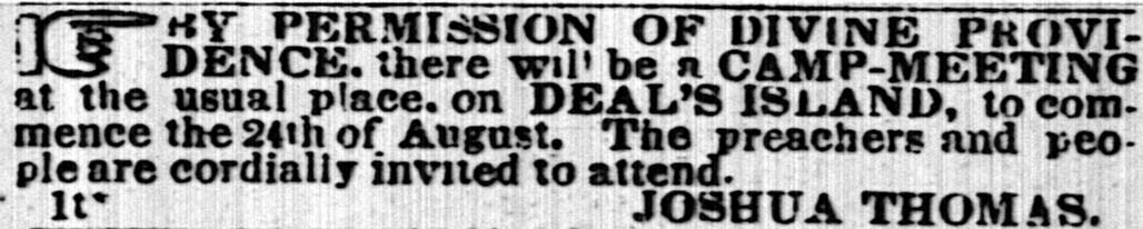 It was 17 July 1828 where Joshua Thomas (click link to see more on Joshua Thomas) started holding his famous Camp Meetings on Deal Island. Thousands from all around came by large and small sailing boats to hear his fiery sermons. In 1850 a new church was completed near the camp ground where the land was donated by Captain John Parks and his brother Charlie. This became known as the
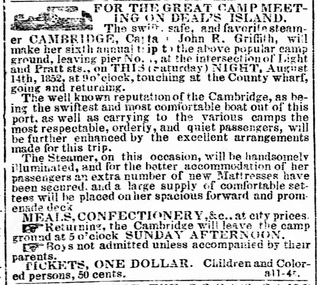
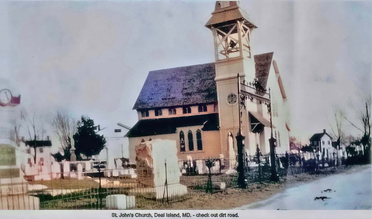 In 1879 a new larger church was built in front of the Joshua Thomas Chapel on Deal Island. The people of the Island also attended Rock Church before their own church was built. Later, two other Methodist Churches were built on the Island. One at Wenona and the Deal Island Church for the colored population. I, myself (author and website administrator) can attest to the Methodist influence of the area as my own name Wesley comes from my family living there.
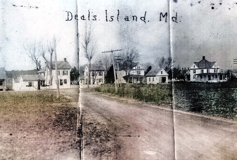

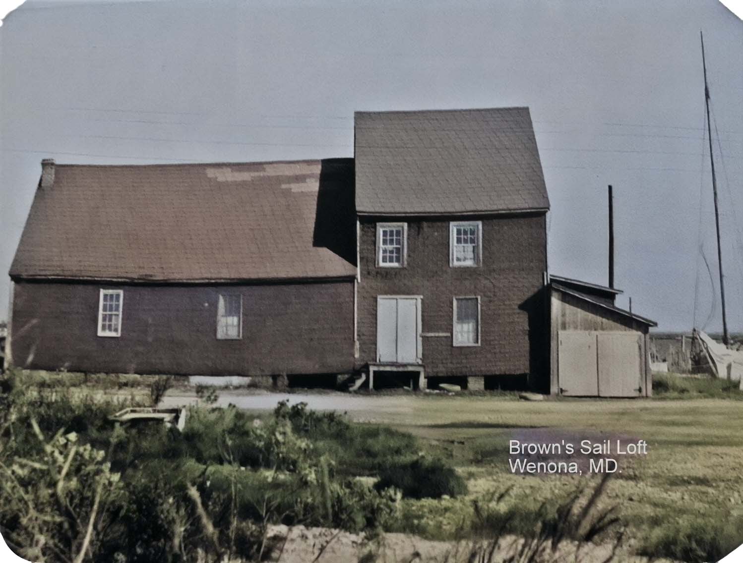 Sailmaking was very important and crucial to the Islanders. Captain John Stubble operated a sail loft before the Civil War. Mr. Henry Brown an Englishman came to America and joined the Navy. After the Civil War he worked for Captain Stubbs having learned the intricate sailmaking trade in the Navy. In 1870 he bought the business from Captain Stubbs and continued to make and repair sails for Schooners from Cape Cod and the West Indies to Baltimore. In 1919 his son Albert Brown took over the business where eventually Albert’s son Henry Brown took over. Mr. Henry and his daughter were the salt of the earth type people I can attest personally when they made sails for my family’s own Skipjack.
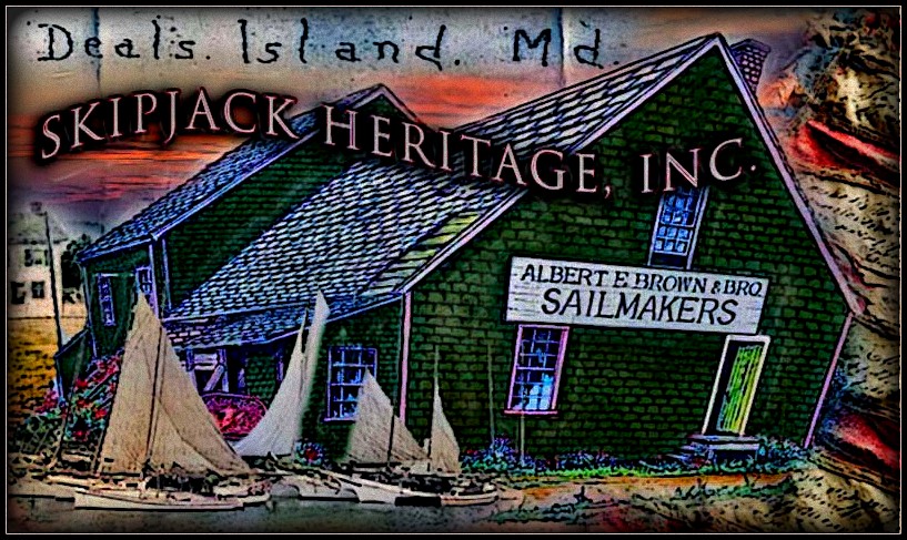 service. The Webster blacksmith shop operated for almost a century until the death of Rolan Webster.
 started scheduled trips to Chesapeake Bay settlements. It drastically changed the pattern of living for the Islanders. The doors to the outside world were opened, a period of great activity and considerable prosperity followed. Goner was the simple quiet life of the early settlers. Captain Levin Anderson gave the Baltimore Chesapeake and Atlantic Steamship Company the land for building a wharf at the northern end of the Island. In order to reach sufficiently deep water, the pier ran out about a quarter mile from the shore.
 .jpeg)
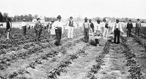 By the 1900’s strawberries, beans, potatoes and tomatoes fresh and canned were being shipped in large volume to Baltimore. There were also shipments of chickens and cattle. Albert Anderson, son of founder of the Anderson Hotel recalled seeing 500 crates of strawberries from the Bradshaw farm being loaded one day and they were the large crates holding 32-48 or 60 quarts.
 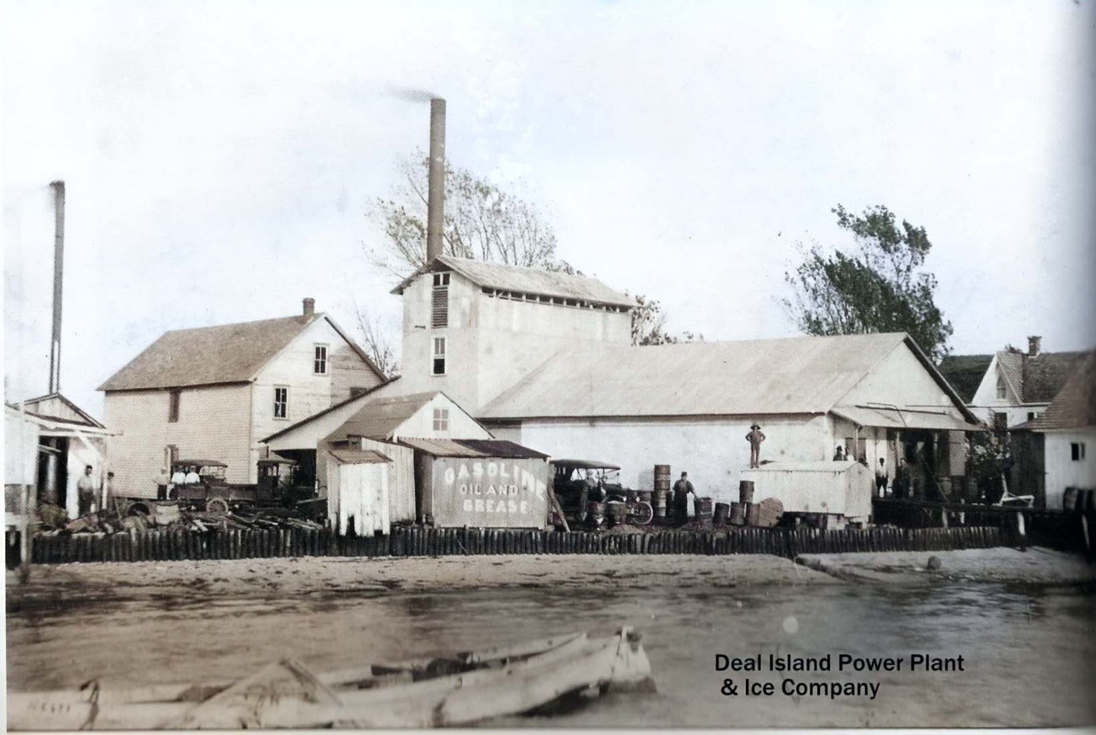 On the pier an icehouse was operated by Adophus and Ralph Brown. On the waters edge to the south of the wharf another ice plant was started in 1916 by Thompson Wallace. Near this plant Harry Wilson opened the first garage in the early 1920’s then later built a new garage and Ford salesroom, which is now the Firehouse (1970).
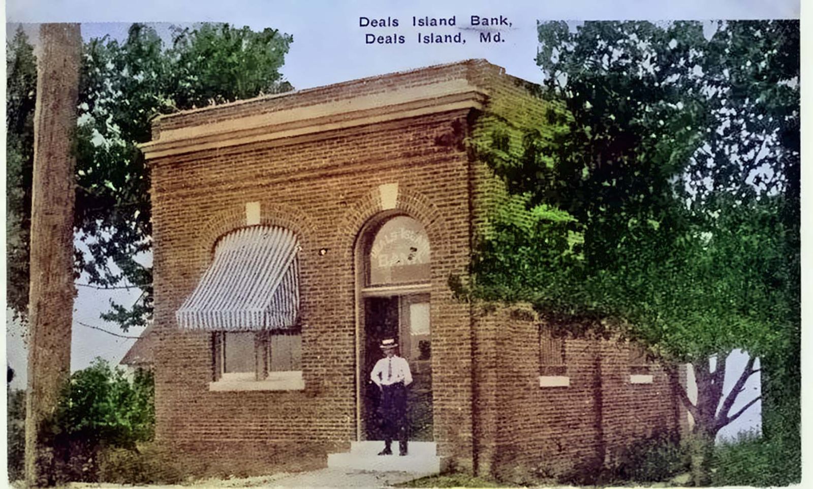 Some years later a new bank was built, a branch pf the Bank of Somerset with Arthur Andrews as cashier and Edelen webster as assistant cashier, This bank closed in 1929 (Stock Market crash).
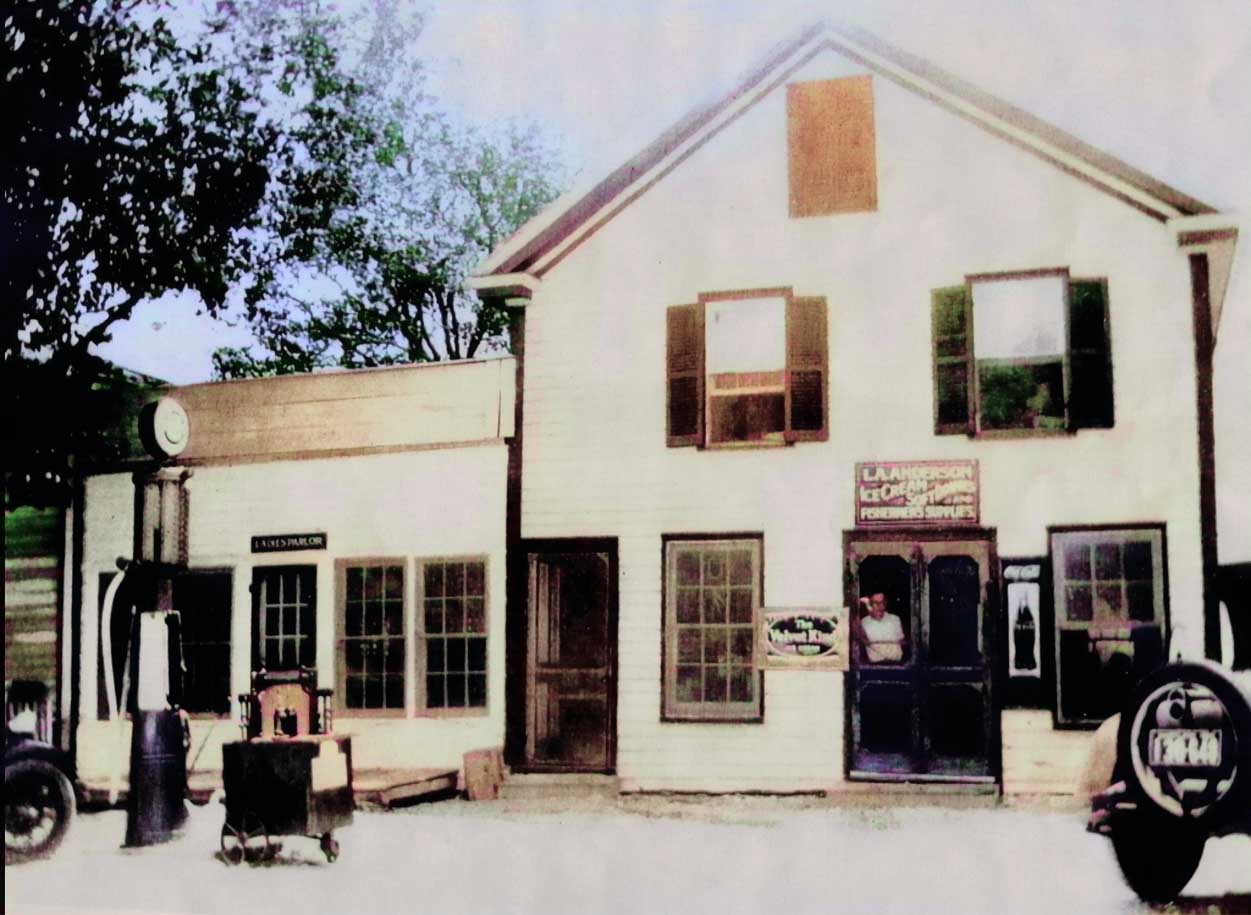
 matches that drew many customers from the mainland. There were ice skating parties and taffy pulls in the wintertime and lawn parties in the summer where the lawns were elaborately decorated with Japanese lanterns where homemade ice cream was served for refreshments. Life was pleasant, a few young people wanted to leave their Island homes for metropolitan living.